Guarenas geodata
Guarenas (Miranda) is a seat of a second-order administrative division; located in Venezuela in America/Caracas (GMT-4) time zone. With population of 181,612 people, there are 24 cities with bigger population in this country. Compared to other cities in Venezuela, 80.7% of cities are located further ↓South; 75.8% of cities are located further ←West and 74.3% of cities have lower elevation than Guarenas. Note1


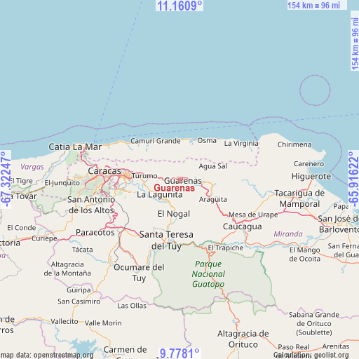
Guarenas GPS coordinates[2]
10° 28' 12.972" North, 66° 37' 9.624" West
| Map corner | latitude | longitude |
|---|---|---|
| Upper-left | 11.1609°, | -67.32247° |
| Center: | 10.47027°, | -66.61934° |
| Lower-right: | 9.7781°, | -65.91622° |
| Map W x H: | 153.8×153.8 km | = 95.6×95.6mi |
| max Lat: | 11.94788° ⇑19.3% North |
| Guarenas: | 10.47027° |
| min Lat: | ⇓80.7% South 1.92027° |
| min Long | Guarenas | max Long |
| -72.55212° | -66.61934° | -60.99778° |
| W 75.8%⇐ | ⇒24.2% E |
Elevation
Elevation of Guarenas is 523 m = 1716 ft, and this is 142.4 m = 467 ft above average elevation for this country.
| Max E: |
2986 m = 9797 ft | 25.7% |
| Guarenas | 523 m 1716 ft | |
| Avg. | 380.6 m = 1249 ft | |
Min E: |
-4 m = -13 ft | 74.3% |
See also: Guarenas elevation on elevation.city.
Geographical zone
Guarenas is located in North Torrid zone (between Equator and Tropic of Cancer). Distance of Equator is 1164.2 km =723.4 mi to South.| Distance of | km | miles | from Guarenas |
|---|---|---|---|
| North Pole | 8842.9 | 5494.7 | to North |
| Arctic Circle | 6237 | 3875.5 | to North |
| Tropic Cancer | 1441.7 | 895.8 | to North |
| Equator | 1164.2 | 723.4 | to South |


Nearby cities:
15 places around Guarenas: (largest is in red/bold)
• Baruta
28.3 km =17.6 mi,  261°
261°
• Caraballeda
29.9 km =18.6 mi,  301°
301°
• Caracas
28.5 km =17.7 mi,  273°
273°
• Caucaguita
23.6 km =14.7 mi,  238°
238°
• Caucagüito
13.1 km =8.1 mi,  277°
277°
• Chacao
25.8 km =16 mi, 276°
• El Cafetal
23 km =14.3 mi, 268°
• El Hatillo
23.2 km =14.4 mi, 257°
• Guatire
8.4 km =5.2 mi,  87°
87°
• La Dolorita
18.3 km =11.4 mi, 276°
• Los Dos Caminos
23 km =14.3 mi, 276°
• Naiguatá
21.1 km =13.1 mi,  322°
322°
• Petare
20.6 km =12.8 mi, 272°
• Santa Lucía
18.9 km =11.7 mi,  193°
193°
• Santa Teresa del Tuy
26.9 km =16.7 mi, 190°
Sources, notices
• [Note1] Compared only with cities in Venezuela existing in our database
• [Src1] Map data: © OpenStreetMap contributors (CC-BY-SA)
• [Src2] Other city data from geonames.org with taken over terms of usage.
• [Src3] Geographical zone / Annual Mean Temperature by Robert A. Rohde @ Wikipedia
