Lecherías geodata
Lecherías (Anzoátegui) is a seat of a second-order administrative division; located in Venezuela in America/Caracas (GMT-4) time zone. In our database, there are 108 cities with bigger population. Compared to other cities in Venezuela, 67.4% of cities are located further ↓South; 84% of cities are located further ←West and 99.2% of cities have higher elevation than Lecherías. Note1


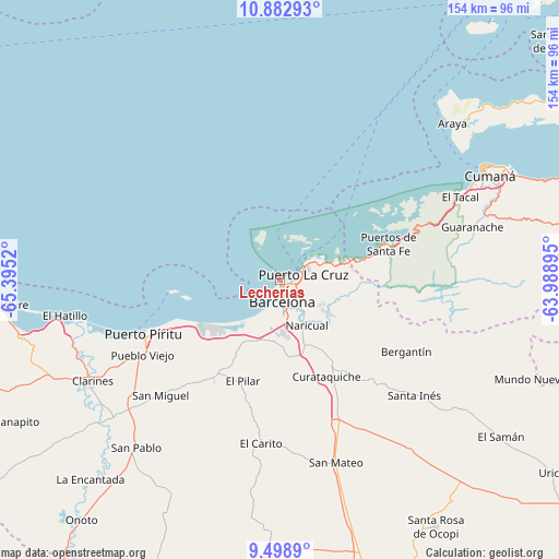
Lecherías GPS coordinates[2]
10° 11' 30.012" North, 64° 41' 31.452" West
| Map corner | latitude | longitude |
|---|---|---|
| Upper-left | 10.88293°, | -65.3952° |
| Center: | 10.19167°, | -64.69207° |
| Lower-right: | 9.4989°, | -63.98895° |
| Map W x H: | 153.9×153.9 km | = 95.6×95.6mi |
| max Lat: | 11.94788° ⇑32.6% North |
| Lecherías: | 10.19167° |
| min Lat: | ⇓67.4% South 1.92027° |
| min Long | Lecherías | max Long |
| -72.55212° | -64.69207° | -60.99778° |
| W 84%⇐ | ⇒16% E |
Elevation
Elevation of Lecherías is 1 m = 3 ft, and this is 379.6 m = 1245 ft below average elevation for this country.
| Max E: |
2986 m = 9797 ft | 99.2% |
| Avg. | 380.6 m = 1249 ft | |
| Lecherías | 1 m = 3 ft | |
Min E: |
-4 m = -13 ft | 0.8% |
See also: Venezuela elevation on elevation.city.
Geographical zone
Lecherías is located in North Torrid zone (between Equator and Tropic of Cancer). Distance of Equator is 1133.2 km =704.1 mi to South.| Distance of | km | miles | from Lecherías |
|---|---|---|---|
| North Pole | 8873.9 | 5514 | to North |
| Arctic Circle | 6268 | 3894.8 | to North |
| Tropic Cancer | 1472.7 | 915.1 | to North |
| Equator | 1133.2 | 704.1 | to South |


Nearby cities:
15 places around Lecherías: (largest is in red/bold)
• Anaco
88.3 km =54.9 mi,  163°
163°
• Aragua de Barcelona
83.2 km =51.7 mi,  190°
190°
• Araya
64.4 km =40 mi,  47°
47°
• Barcelona
6.2 km =3.9 mi,  174°
174°
• Boca de Uchire
80.2 km =49.8 mi,  265°
265°
• Clarines
58.9 km =36.6 mi,  241°
241°
• Cumanacoa
84.8 km =52.7 mi,  85°
85°
• Cumaná
62.9 km =39.1 mi,  62°
62°
• Guanta
11.4 km =7.1 mi,  65°
65°
• Marigüitar
91 km =56.5 mi, 71°
• Onoto
85.9 km =53.4 mi,  219°
219°
• Puerto La Cruz
6.9 km =4.3 mi, 69°
• Puerto Píritu
40.5 km =25.2 mi,  248°
248°
• Píritu
40.7 km =25.3 mi, 245°
• San Mateo
52.6 km =32.7 mi, 162°
Sources, notices
• [Note1] Compared only with cities in Venezuela existing in our database
• [Src1] Map data: © OpenStreetMap contributors (CC-BY-SA)
• [Src2] Other city data from geonames.org with taken over terms of usage.
• [Src3] Geographical zone / Annual Mean Temperature by Robert A. Rohde @ Wikipedia
