Barcelona geodata
Barcelona (Anzoátegui) is a seat of a first-order administrative division; located in Venezuela in America/Caracas (GMT-4) time zone. With population of 424,795 people, there are 6 cities with bigger population in this country. Compared to other cities in Venezuela, 63.4% of cities are located further ↓South; 84.2% of cities are located further ←West and 92.6% of cities have higher elevation than Barcelona. Note1


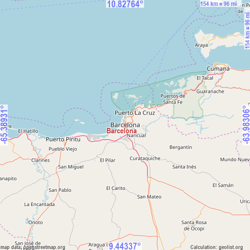
Barcelona GPS coordinates[2]
10° 8' 10.5" North, 64° 41' 10.248" West
| Map corner | latitude | longitude |
|---|---|---|
| Upper-left | 10.82764°, | -65.38931° |
| Center: | 10.13625°, | -64.68618° |
| Lower-right: | 9.44337°, | -63.98306° |
| Map W x H: | 153.9×153.9 km | = 95.6×95.6mi |
| max Lat: | 11.94788° ⇑36.6% North |
| Barcelona: | 10.13625° |
| min Lat: | ⇓63.4% South 1.92027° |
| min Long | Barcelona | max Long |
| -72.55212° | -64.68618° | -60.99778° |
| W 84.2%⇐ | ⇒15.8% E |
Elevation
Elevation of Barcelona is 8 m = 26 ft, and this is 372.6 m = 1222 ft below average elevation for this country.
| Max E: |
2986 m = 9797 ft | 92.6% |
| Avg. | 380.6 m = 1249 ft | |
| Barcelona | 8 m = 26 ft | |
Min E: |
-4 m = -13 ft | 7.4% |
See also: Barcelona elevation on elevation.city.
Geographical zone
Barcelona is located in North Torrid zone (between Equator and Tropic of Cancer). Distance of Equator is 1127 km =700.3 mi to South.| Distance of | km | miles | from Barcelona |
|---|---|---|---|
| North Pole | 8880 | 5517.8 | to North |
| Arctic Circle | 6274.1 | 3898.5 | to North |
| Tropic Cancer | 1478.9 | 918.9 | to North |
| Equator | 1127 | 700.3 | to South |


Nearby cities:
15 places around Barcelona: (largest is in red/bold)
• Anaco
82.3 km =51.1 mi,  162°
162°
• Aragua de Barcelona
77.3 km =48 mi,  191°
191°
• Araya
68.2 km =42.4 mi,  43°
43°
• Boca de Uchire
80.6 km =50.1 mi,  269°
269°
• Clarines
56.8 km =35.3 mi,  247°
247°
• Cumanacoa
84.9 km =52.8 mi,  81°
81°
• Cumaná
65.4 km =40.6 mi,  57°
57°
• Guanta
14.6 km =9.1 mi, 41°
• Lecherías
6.2 km =3.9 mi,  354°
354°
• Onoto
81.7 km =50.8 mi,  222°
222°
• Puerto La Cruz
10.4 km =6.5 mi,  34°
34°
• Puerto Píritu
39.4 km =24.5 mi,  257°
257°
• Píritu
39.2 km =24.4 mi, 254°
• San Mateo
46.5 km =28.9 mi, 161°
• Santa Ana
92.4 km =57.4 mi,  177°
177°
Sources, notices
• [Note1] Compared only with cities in Venezuela existing in our database
• [Src1] Map data: © OpenStreetMap contributors (CC-BY-SA)
• [Src2] Other city data from geonames.org with taken over terms of usage.
• [Src3] Geographical zone / Annual Mean Temperature by Robert A. Rohde @ Wikipedia
