Isla Ratón geodata
Isla Ratón (Amazonas) is a seat of a second-order administrative division; located in Venezuela in America/Caracas (GMT-4) time zone. In our database, there are 108 cities with bigger population. Compared to other cities in Venezuela, 98.7% of cities are located further ↑North; 59.8% of cities are located further ←West and 78.1% of cities have higher elevation than Isla Ratón. Note1


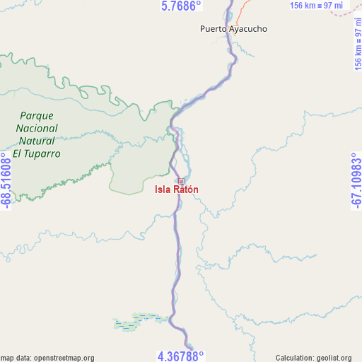
Isla Ratón GPS coordinates[2]
5° 4' 7.032" North, 67° 48' 46.62" West
| Map corner | latitude | longitude |
|---|---|---|
| Upper-left | 5.7686°, | -68.51608° |
| Center: | 5.06862°, | -67.81295° |
| Lower-right: | 4.36788°, | -67.10983° |
| Map W x H: | 155.7×155.7 km | = 96.7×96.7mi |
| max Lat: | 11.94788° ⇑98.7% North |
| Isla Ratón: | 5.06862° |
| min Lat: | ⇓1.3% South 1.92027° |
| min Long | Isla Ratón | max Long |
| -72.55212° | -67.81295° | -60.99778° |
| W 59.8%⇐ | ⇒40.2% E |
Elevation
Elevation of Isla Ratón is 57 m = 187 ft, and this is 323.6 m = 1062 ft below average elevation for this country.
| Max E: |
2986 m = 9797 ft | 78.1% |
| Avg. | 380.6 m = 1249 ft | |
| Isla Ratón | 57 m = 187 ft | |
Min E: |
-4 m = -13 ft | 21.9% |
See also: Venezuela elevation on elevation.city.
Geographical zone
Isla Ratón is located in North Torrid zone (between Equator and Tropic of Cancer). Distance of Equator is 563.6 km =350.2 mi to South.| Distance of | km | miles | from Isla Ratón |
|---|---|---|---|
| North Pole | 9443.5 | 5867.9 | to North |
| Arctic Circle | 6837.6 | 4248.7 | to North |
| Tropic Cancer | 2042.3 | 1269 | to North |
| Equator | 563.6 | 350.2 | to South |


Nearby cities:
15 places around Isla Ratón: (largest is in red/bold)
• Achaguas
304.8 km =189.4 mi,  351°
351°
• Biruaca
310.4 km =192.9 mi,  6°
6°
• Caicara del Orinoco
338.3 km =210.2 mi,  32°
32°
• Camaguán
338.6 km =210.4 mi,  3°
3°
• Elorza
289.4 km =179.8 mi,  319°
319°
• Guayabal
329.2 km =204.6 mi, 8°
• La Esmeralda
328 km =203.8 mi,  129°
129°
• Maroa
262.8 km =163.3 mi,  173°
173°
• Puerto Ayacucho
70.5 km =43.8 mi,  21°
21°
• San Antonio
329.1 km =204.5 mi, 347°
• San Fernando de Apure
315.7 km =196.2 mi, 6°
• San Fernando de Atabapo
114.4 km =71.1 mi, 173°
• San Juan de Manapiare
196.9 km =122.3 mi,  81°
81°
• San Juan de Payara
287.5 km =178.6 mi, 4°
• Santa Catalina
340.1 km =211.3 mi,  338°
338°
Sources, notices
• [Note1] Compared only with cities in Venezuela existing in our database
• [Src1] Map data: © OpenStreetMap contributors (CC-BY-SA)
• [Src2] Other city data from geonames.org with taken over terms of usage.
• [Src3] Geographical zone / Annual Mean Temperature by Robert A. Rohde @ Wikipedia
