Achaguas geodata
Achaguas (Apure) is a seat of a second-order administrative division; located in Venezuela in America/Caracas (GMT-4) time zone. In our database, there are 108 cities with bigger population. Compared to other cities in Venezuela, 92.1% of cities are located further ↑North; 56.7% of cities are located further ←West and 76.3% of cities have higher elevation than Achaguas. Note1


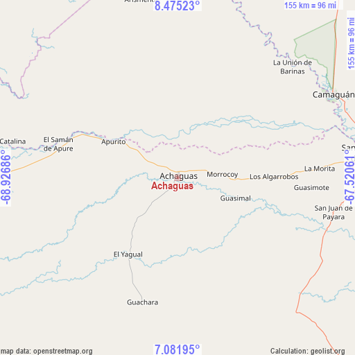
Achaguas GPS coordinates[2]
7° 46' 45.012" North, 68° 13' 25.428" West
| Map corner | latitude | longitude |
|---|---|---|
| Upper-left | 8.47523°, | -68.92686° |
| Center: | 7.77917°, | -68.22373° |
| Lower-right: | 7.08195°, | -67.52061° |
| Map W x H: | 154.9×154.9 km | = 96.3×96.3mi |
| max Lat: | 11.94788° ⇑92.1% North |
| Achaguas: | 7.77917° |
| min Lat: | ⇓7.9% South 1.92027° |
| min Long | Achaguas | max Long |
| -72.55212° | -68.22373° | -60.99778° |
| W 56.7%⇐ | ⇒43.3% E |
Elevation
Elevation of Achaguas is 62 m = 203 ft, and this is 318.6 m = 1045 ft below average elevation for this country.
| Max E: |
2986 m = 9797 ft | 76.3% |
| Avg. | 380.6 m = 1249 ft | |
| Achaguas | 62 m = 203 ft | |
Min E: |
-4 m = -13 ft | 23.7% |
See also: Venezuela elevation on elevation.city.
Geographical zone
Achaguas is located in North Torrid zone (between Equator and Tropic of Cancer). Distance of Equator is 865 km =537.5 mi to South.| Distance of | km | miles | from Achaguas |
|---|---|---|---|
| North Pole | 9142.1 | 5680.6 | to North |
| Arctic Circle | 6536.2 | 4061.4 | to North |
| Tropic Cancer | 1741 | 1081.8 | to North |
| Equator | 865 | 537.5 | to South |


Nearby cities:
15 places around Achaguas: (largest is in red/bold)
• Arismendi
79.5 km =49.4 mi,  348°
348°
• Biruaca
78.2 km =48.6 mi,  84°
84°
• Bruzual
125.8 km =78.2 mi,  283°
283°
• Camaguán
77.1 km =47.9 mi,  61°
61°
• Ciudad De Nutrias
124.5 km =77.4 mi,  286°
286°
• El Baúl
131.8 km =81.9 mi,  356°
356°
• El Regalo
127.7 km =79.3 mi,  304°
304°
• Guadarrama
86.2 km =53.6 mi,  12°
12°
• Guayabal
94.3 km =58.6 mi,  74°
74°
• La Unión
69.9 km =43.4 mi,  46°
46°
• Puerto de Nutrias
123.2 km =76.6 mi, 285°
• San Antonio
30.9 km =19.2 mi,  311°
311°
• San Fernando de Apure
83.6 km =51.9 mi, 81°
• San Juan de Payara
69.5 km =43.2 mi,  102°
102°
• Santa Catalina
78.1 km =48.5 mi, 281°
Sources, notices
• [Note1] Compared only with cities in Venezuela existing in our database
• [Src1] Map data: © OpenStreetMap contributors (CC-BY-SA)
• [Src2] Other city data from geonames.org with taken over terms of usage.
• [Src3] Geographical zone / Annual Mean Temperature by Robert A. Rohde @ Wikipedia
