Camaguán geodata
Camaguán (Guárico) is a seat of a second-order administrative division; located in Venezuela in America/Caracas (GMT-4) time zone. In our database, there are 108 cities with bigger population. Compared to other cities in Venezuela, 84% of cities are located further ↑North; 61.8% of cities are located further ←West and 77.1% of cities have higher elevation than Camaguán. Note1


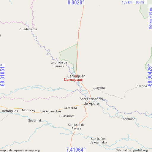
Camaguán GPS coordinates[2]
8° 6' 26.352" North, 67° 36' 26.568" West
| Map corner | latitude | longitude |
|---|---|---|
| Upper-left | 8.8028°, | -68.31051° |
| Center: | 8.10732°, | -67.60738° |
| Lower-right: | 7.41064°, | -66.90426° |
| Map W x H: | 154.8×154.8 km | = 96.2×96.2mi |
| max Lat: | 11.94788° ⇑84% North |
| Camaguán: | 8.10732° |
| min Lat: | ⇓16% South 1.92027° |
| min Long | Camaguán | max Long |
| -72.55212° | -67.60738° | -60.99778° |
| W 61.8%⇐ | ⇒38.2% E |
Elevation
Elevation of Camaguán is 60 m = 197 ft, and this is 320.6 m = 1052 ft below average elevation for this country.
| Max E: |
2986 m = 9797 ft | 77.1% |
| Avg. | 380.6 m = 1249 ft | |
| Camaguán | 60 m = 197 ft | |
Min E: |
-4 m = -13 ft | 22.9% |
See also: Venezuela elevation on elevation.city.
Geographical zone
Camaguán is located in North Torrid zone (between Equator and Tropic of Cancer). Distance of Equator is 901.4 km =560.1 mi to South.| Distance of | km | miles | from Camaguán |
|---|---|---|---|
| North Pole | 9105.6 | 5658 | to North |
| Arctic Circle | 6499.7 | 4038.7 | to North |
| Tropic Cancer | 1704.5 | 1059.1 | to North |
| Equator | 901.4 | 560.1 | to South |


Nearby cities:
15 places around Camaguán: (largest is in red/bold)
• Achaguas
77.1 km =47.9 mi,  241°
241°
• Arismendi
93.6 km =58.2 mi,  296°
296°
• Biruaca
30.8 km =19.1 mi,  161°
161°
• Caicara del Orinoco
167 km =103.8 mi,  108°
108°
• Calabozo
92.9 km =57.7 mi,  12°
12°
• El Baúl
121.5 km =75.5 mi,  321°
321°
• El Sombrero
154.5 km =96 mi,  22°
22°
• Guadarrama
68 km =42.3 mi,  314°
314°
• Guayabal
26 km =16.2 mi,  117°
117°
• La Unión
21.3 km =13.2 mi, 304°
• Palmasola
158.9 km =98.7 mi,  38°
38°
• San Antonio
92.4 km =57.4 mi,  260°
260°
• San Fernando de Apure
28.6 km =17.8 mi,  148°
148°
• San Juan de Payara
51.3 km =31.9 mi,  179°
179°
• Santa Catalina
145.7 km =90.5 mi, 261°
Sources, notices
• [Note1] Compared only with cities in Venezuela existing in our database
• [Src1] Map data: © OpenStreetMap contributors (CC-BY-SA)
• [Src2] Other city data from geonames.org with taken over terms of usage.
• [Src3] Geographical zone / Annual Mean Temperature by Robert A. Rohde @ Wikipedia
