Al Jawl geodata
Al Jawl (Ḩaḑramawt) is a seat of a second-order administrative division; located in Yemen in Asia/Aden (GMT+3) time zone. In our database, there are 51 cities with bigger population. Compared to other cities in Yemen, 61.4% of cities are located further ↑North; 89% of cities are located further ←West and 81.8% of cities have higher elevation than Al Jawl. Note1


Al Jawl GPS coordinates[2]
14° 27' 22.5" North, 48° 16' 50.376" East
| Map corner | latitude | longitude |
|---|---|---|
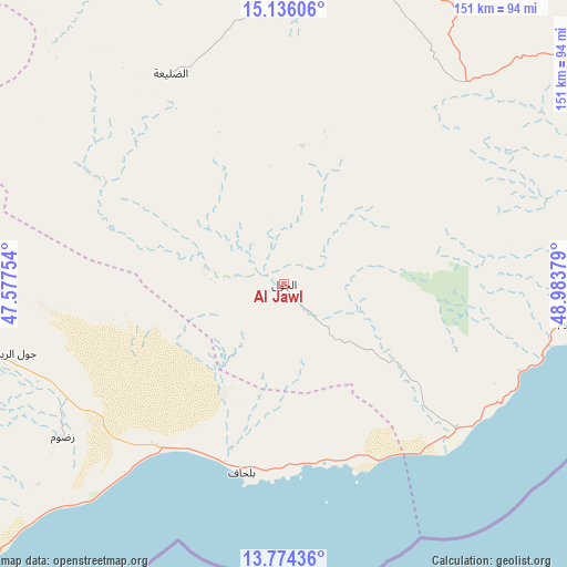
| Upper-left | 15.13606°, | 47.57754° |
| Center: | 14.45625°, | 48.28066° |
| Lower-right: | 13.77436°, | 48.98379° |
| Map W x H: | 151.4×151.4 km | = 94.1×94.1mi |
| max Lat: | 17.76999° ⇑61.4% North |
| Al Jawl: | 14.45625° |
| min Lat: | ⇓38.6% South 12.18576° |
| min Long | Al Jawl | max Long |
| 42.67107° | 48.28066° | 54.01895° |
| W 89%⇐ | ⇒11% E |
Elevation
Elevation of Al Jawl is 349 m = 1145 ft, and this is 955.8 m = 3136 ft below average elevation for this country.
| Max E: |
2791 m = 9157 ft | 81.8% |
| Avg. | 1304.8 m = 4281 ft | |
| Al Jawl | 349 m = 1145 ft | |
Min E: |
4 m = 13 ft | 18.2% |
See also: Yemen elevation on elevation.city.
Geographical zone
Al Jawl is located in North Torrid zone (between Equator and Tropic of Cancer). Distance of this Northern Tropic circle is 998.5 km =620.4 mi to North.| Distance of | km | miles | from Al Jawl |
|---|---|---|---|
| North Pole | 8399.7 | 5219.3 | to North |
| Arctic Circle | 5793.8 | 3600.1 | to North |
| Tropic Cancer | 998.5 | 620.4 | to North |
| Equator | 1607.4 | 998.8 | to South |


Nearby cities:
15 places around Al Jawl: (largest is in red/bold)
• Al Bāţinah
115.4 km =71.7 mi,  8°
8°
• Al Shirūj
60.6 km =37.7 mi,  294°
294°
• Al ‘Ulayb
114.7 km =71.3 mi,  47°
47°
• Ar Rawḑah
108.1 km =67.2 mi,  270°
270°
• Az̧ Z̧alī‘ah
68.5 km =42.6 mi,  335°
335°
• Aţ Ţalḩ
122.6 km =76.2 mi,  309°
309°
• Burūm
76 km =47.2 mi,  97°
97°
• Ghayl Bā Wazīr
122.1 km =75.9 mi,  73°
73°
• Mayfa‘ah
77.7 km =48.3 mi,  254°
254°
• Mukalla
91.3 km =56.7 mi,  83°
83°
• Ruḑūm
71.1 km =44.2 mi,  234°
234°
• Şanā’
118.6 km =73.7 mi,  332°
332°
• Şīf
95.5 km =59.3 mi,  3°
3°
• Ḩurayḑah
127.5 km =79.2 mi,  355°
355°
• ‘Amd
99.1 km =61.6 mi, 341°
Sources, notices
• [Note1] Compared only with cities in Yemen existing in our database
• [Src1] Map data: © OpenStreetMap contributors (CC-BY-SA)
• [Src2] Other city data from geonames.org with taken over terms of usage.
• [Src3] Geographical zone / Annual Mean Temperature by Robert A. Rohde @ Wikipedia
