Al Māfūd geodata
Al Māfūd (Shabwah) is a seat of a second-order administrative division; located in Yemen in Asia/Aden (GMT+3) time zone. In our database, there are 51 cities with bigger population. Compared to other cities in Yemen, 60.4% of cities are located further ↓South; 84.7% of cities are located further ←West and 63.6% of cities have higher elevation than Al Māfūd. Note1


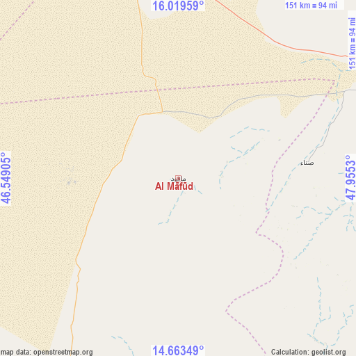
Al Māfūd GPS coordinates[2]
15° 20' 33.504" North, 47° 15' 7.812" East
| Map corner | latitude | longitude |
|---|---|---|
| Upper-left | 16.01959°, | 46.54905° |
| Center: | 15.34264°, | 47.25217° |
| Lower-right: | 14.66349°, | 47.9553° |
| Map W x H: | 150.8×150.8 km | = 93.7×93.7mi |
| max Lat: | 17.76999° ⇑39.6% North |
| Al Māfūd: | 15.34264° |
| min Lat: | ⇓60.4% South 12.18576° |
| min Long | Al Māfūd | max Long |
| 42.67107° | 47.25217° | 54.01895° |
| W 84.7%⇐ | ⇒15.3% E |
Elevation
Elevation of Al Māfūd is 1054 m = 3458 ft, and this is 250.8 m = 823 ft below average elevation for this country.
| Max E: |
2791 m = 9157 ft | 63.6% |
| Avg. | 1304.8 m = 4281 ft | |
| Al Māfūd | 1054 m = 3458 ft | |
Min E: |
4 m = 13 ft | 36.4% |
See also: Yemen elevation on elevation.city.
Geographical zone
Al Māfūd is located in North Torrid zone (between Equator and Tropic of Cancer). Distance of this Northern Tropic circle is 900 km =559.2 mi to North.| Distance of | km | miles | from Al Māfūd |
|---|---|---|---|
| North Pole | 8301.1 | 5158.1 | to North |
| Arctic Circle | 5695.2 | 3538.8 | to North |
| Tropic Cancer | 900 | 559.2 | to North |
| Equator | 1705.9 | 1060 | to South |


Nearby cities:
15 places around Al Māfūd: (largest is in red/bold)
• Al Shirūj
91.8 km =57 mi,  142°
142°
• Al ‘Abr
88.4 km =54.9 mi,  358°
358°
• Ar Rawḑah
97.4 km =60.5 mi,  178°
178°
• Ataq
100.2 km =62.3 mi,  206°
206°
• Az̧ Z̧alī‘ah
89.7 km =55.7 mi,  113°
113°
• Aţ Ţalḩ
26.1 km =16.2 mi, 142°
• Jawl al Majma‘
51.6 km =32.1 mi, 207°
• Maţarah
45.7 km =28.4 mi,  63°
63°
• Said
119.7 km =74.4 mi,  199°
199°
• Şanā’
55.5 km =34.5 mi,  83°
83°
• Şīf
115.6 km =71.8 mi,  91°
91°
• Ḩabbān
111.5 km =69.3 mi,  189°
189°
• Ḩajar al Mashā’ikh
108.2 km =67.2 mi,  35°
35°
• Ḩurayḑah
103.7 km =64.4 mi,  74°
74°
• ‘Amd
78.6 km =48.8 mi, 93°
Sources, notices
• [Note1] Compared only with cities in Yemen existing in our database
• [Src1] Map data: © OpenStreetMap contributors (CC-BY-SA)
• [Src2] Other city data from geonames.org with taken over terms of usage.
• [Src3] Geographical zone / Annual Mean Temperature by Robert A. Rohde @ Wikipedia
