Zeerust geodata
Zeerust (North-West) is a seat of a third-order administrative division; located in South Africa in Africa/Johannesburg (GMT+2) time zone. With population of 17,708 people, there are 153 cities with bigger population in this country. Compared to other cities in South Africa, 89.1% of cities are located further ↓South; 68.4% of cities are located further →East and 56.9% of cities have lower elevation than Zeerust. Note1
Administrative division(s):
- Level 1: North-West
- Level 2: Ngaka Modiri Molema District Municipality
- Level 3: Ramotshere Moiloa


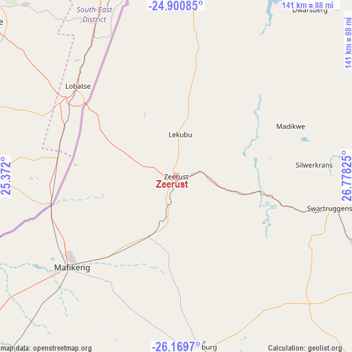
Zeerust GPS coordinates[2]
25° 32' 13.02" South, 26° 4' 30.432" East
| Map corner | latitude | longitude |
|---|---|---|
| Upper-left | -24.90085°, | 25.372° |
| Center: | -25.53695°, | 26.07512° |
| Lower-right: | -26.1697°, | 26.77825° |
| Map W x H: | 141.1×141.1 km | = 87.7×87.7mi |
| max Lat: | -22.34881° ⇑10.9% North |
| Zeerust: | -25.53695° |
| min Lat: | ⇓89.1% South -34.66739° |
| min Long | Zeerust | max Long |
| 16.8697° | 26.07512° | 32.26762° |
| W 31.6%⇐ | ⇒68.4% E |
Elevation
Elevation of Zeerust is 1213 m = 3980 ft, and this is 243.4 m = 799 ft above average elevation for this country.
| Max E: |
1873 m = 6145 ft | 43.1% |
| Zeerust | 1213 m 3980 ft | |
| Avg. | 969.6 m = 3181 ft | |
Min E: |
7 m = 23 ft | 56.9% |
See also: South Africa elevation on elevation.city.
Geographical zone
Zeerust is located in South temperate zone (between Tropic of Capricorn and the Antarctic Circle). Distance of this Southern Tropic circle is 233.5 km =145.1 mi to North.| Distance of | km | miles | from Zeerust |
|---|---|---|---|
| Equator | 2839.4 | 1764.3 | to North |
| Tropic Capricorn | 233.5 | 145.1 | to North |
| Antarctic Circle | 4561.7 | 2834.5 | to South |
| South Pole | 7167.6 | 4453.7 | to South |


Nearby cities:
15 places around Zeerust: (largest is in red/bold)
• Carletonville
160.9 km =100 mi,  124°
124°
• Delareyville
141.8 km =88.1 mi,  205°
205°
• Klerksdorp
157.7 km =98 mi,  158°
158°
• Koster
90 km =55.9 mi,  113°
113°
• Lichtenburg
68.9 km =42.8 mi,  172°
172°
• Mahikeng
56.5 km =35.1 mi,  229°
229°
• Maile
121.6 km =75.6 mi,  84°
84°
• Mmabatho
56.3 km =35 mi, 231°
• Mogwase
118.2 km =73.4 mi, 75°
• Orkney
171.2 km =106.4 mi, 159°
• Potchefstroom
166.4 km =103.4 mi,  142°
142°
• Rustenburg
117.9 km =73.3 mi,  97°
97°
• Stilfontein
161 km =100 mi,  154°
154°
• Thabazimbi
170.8 km =106.1 mi,  52°
52°
• Ventersdorp
114.2 km =71 mi, 139°
Sources, notices
• [Note1] Compared only with cities in South Africa existing in our database
• [Src1] Map data: © OpenStreetMap contributors (CC-BY-SA)
• [Src2] Other city data from geonames.org with taken over terms of usage.
• [Src3] Geographical zone / Annual Mean Temperature by Robert A. Rohde @ Wikipedia
