Lichtenburg geodata
Lichtenburg (North-West) is a seat of a third-order administrative division; located in South Africa in Africa/Johannesburg (GMT+2) time zone. With population of 65,863 people, there are 78 cities with bigger population in this country. Compared to other cities in South Africa, 80.2% of cities are located further ↓South; 67.8% of cities are located further →East and 80.2% of cities have lower elevation than Lichtenburg. Note1
Administrative division(s):
- Level 1: North-West
- Level 2: Ngaka Modiri Molema District Municipality
- Level 3: Ditsobotla


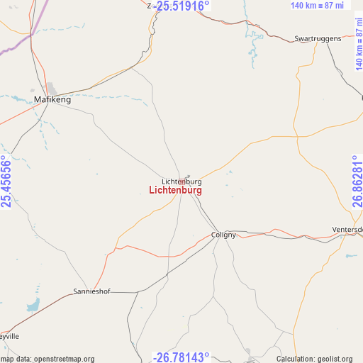
Lichtenburg GPS coordinates[2]
26° 9' 7.2" South, 26° 9' 34.848" East
| Map corner | latitude | longitude |
|---|---|---|
| Upper-left | -25.51916°, | 25.45656° |
| Center: | -26.152°, | 26.15968° |
| Lower-right: | -26.78143°, | 26.86281° |
| Map W x H: | 140.4×140.4 km | = 87.2×87.2mi |
| max Lat: | -22.34881° ⇑19.8% North |
| Lichtenburg: | -26.152° |
| min Lat: | ⇓80.2% South -34.66739° |
| min Long | Lichtenburg | max Long |
| 16.8697° | 26.15968° | 32.26762° |
| W 32.2%⇐ | ⇒67.8% E |
Elevation
Elevation of Lichtenburg is 1486 m = 4875 ft, and this is 516.4 m = 1694 ft above average elevation for this country.
| Max E: |
1873 m = 6145 ft | 19.8% |
| Lichtenburg | 1486 m 4875 ft | |
| Avg. | 969.6 m = 3181 ft | |
Min E: |
7 m = 23 ft | 80.2% |
See also: Lichtenburg elevation on elevation.city.
Geographical zone
Lichtenburg is located in South temperate zone (between Tropic of Capricorn and the Antarctic Circle). Distance of this Southern Tropic circle is 301.9 km =187.6 mi to North.| Distance of | km | miles | from Lichtenburg |
|---|---|---|---|
| Equator | 2907.8 | 1806.8 | to North |
| Tropic Capricorn | 301.9 | 187.6 | to North |
| Antarctic Circle | 4493.3 | 2792 | to South |
| South Pole | 7099.2 | 4411.2 | to South |


Nearby cities:
15 places around Lichtenburg: (largest is in red/bold)
• Carletonville
125.6 km =78 mi,  100°
100°
• Delareyville
91.6 km =56.9 mi,  229°
229°
• Fochville
138.1 km =85.8 mi,  105°
105°
• Klerksdorp
92.8 km =57.7 mi,  147°
147°
• Koster
80.4 km =50 mi,  66°
66°
• Mahikeng
60.6 km =37.7 mi,  301°
301°
• Maile
137.3 km =85.3 mi,  54°
54°
• Mmabatho
62.4 km =38.8 mi, 302°
• Orkney
105.3 km =65.4 mi, 151°
• Potchefstroom
112.7 km =70 mi,  123°
123°
• Rustenburg
120.9 km =75.1 mi,  63°
63°
• Stilfontein
98 km =60.9 mi,  141°
141°
• Ventersdorp
68.5 km =42.6 mi, 105°
• Wolmaransstad
117.6 km =73.1 mi,  188°
188°
• Zeerust
68.9 km =42.8 mi,  352°
352°
Sources, notices
• [Note1] Compared only with cities in South Africa existing in our database
• [Src1] Map data: © OpenStreetMap contributors (CC-BY-SA)
• [Src2] Other city data from geonames.org with taken over terms of usage.
• [Src3] Geographical zone / Annual Mean Temperature by Robert A. Rohde @ Wikipedia
