Thabazimbi geodata
Thabazimbi (Limpopo) is a seat of a third-order administrative division; located in South Africa in Africa/Johannesburg (GMT+2) time zone. With population of 10,365 people, there are 211 cities with bigger population in this country. Compared to other cities in South Africa, 94.4% of cities are located further ↓South; 54% of cities are located further →East and 58.4% of cities have higher elevation than Thabazimbi. Note1
Administrative division(s):
- Level 1: Limpopo
- Level 2: Waterberg District Municipality
- Level 3: Thabazimbi


Thabazimbi GPS coordinates[2]
24° 35' 29.94" South, 27° 24' 41.58" East
| Map corner | latitude | longitude |
|---|---|---|
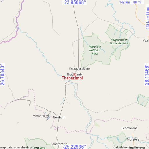
| Upper-left | -23.95068°, | 26.70843° |
| Center: | -24.59165°, | 27.41155° |
| Lower-right: | -25.22936°, | 28.11468° |
| Map W x H: | 142.2×142.2 km | = 88.4×88.4mi |
| max Lat: | -22.34881° ⇑5.6% North |
| Thabazimbi: | -24.59165° |
| min Lat: | ⇓94.4% South -34.66739° |
| min Long | Thabazimbi | max Long |
| 16.8697° | 27.41155° | 32.26762° |
| W 46%⇐ | ⇒54% E |
Elevation
Elevation of Thabazimbi is 979 m = 3212 ft, and this is 9.4 m = 31 ft above average elevation for this country.
| Max E: |
1873 m = 6145 ft | 58.4% |
| Thabazimbi | 979 m 3212 ft | |
| Avg. | 969.6 m = 3181 ft | |
Min E: |
7 m = 23 ft | 41.6% |
See also: South Africa elevation on elevation.city.
Geographical zone
Thabazimbi is located in South temperate zone (between Tropic of Capricorn and the Antarctic Circle). Distance of this Southern Tropic circle is 128.4 km =79.8 mi to North.| Distance of | km | miles | from Thabazimbi |
|---|---|---|---|
| Equator | 2734.3 | 1699 | to North |
| Tropic Capricorn | 128.4 | 79.8 | to North |
| Antarctic Circle | 4666.8 | 2899.8 | to South |
| South Pole | 7272.7 | 4519 | to South |


Nearby cities:
15 places around Thabazimbi: (largest is in red/bold)
• Bela-Bela
94.9 km =59 mi,  110°
110°
• Brits
121.8 km =75.7 mi,  162°
162°
• Centurion
161 km =100 mi,  151°
151°
• Diepsloot
160.9 km =100 mi, 157°
• Ga-Rankuwa
128.2 km =79.7 mi, 152°
• Koster
150.5 km =93.5 mi,  200°
200°
• Lephalale
108.3 km =67.3 mi,  18°
18°
• Mabopane
122.3 km =76 mi, 145°
• Maile
95.4 km =59.3 mi,  187°
187°
• Makapanstad
102.2 km =63.5 mi,  135°
135°
• Modimolle
100.6 km =62.5 mi,  96°
96°
• Mogwase
78.8 km =49 mi, 194°
• Pretoria
150.1 km =93.3 mi, 148°
• Rustenburg
120.8 km =75.1 mi, 188°
• Warmbaths
93.8 km =58.3 mi, 110°
Sources, notices
• [Note1] Compared only with cities in South Africa existing in our database
• [Src1] Map data: © OpenStreetMap contributors (CC-BY-SA)
• [Src2] Other city data from geonames.org with taken over terms of usage.
• [Src3] Geographical zone / Annual Mean Temperature by Robert A. Rohde @ Wikipedia
