Mogwase geodata
Mogwase (North-West) is a seat of a third-order administrative division; located in South Africa in Africa/Johannesburg (GMT+2) time zone. In our database, there are 257 cities with bigger population. Compared to other cities in South Africa, 90.9% of cities are located further ↓South; 56.3% of cities are located further →East and 53.1% of cities have higher elevation than Mogwase. Note1
Administrative division(s):
- Level 1: North-West
- Level 2: Bojanala Platinum District Municipality
- Level 3: Moses Kotane


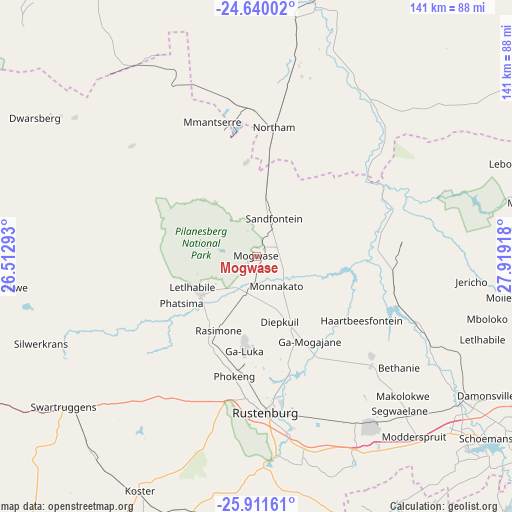
Mogwase GPS coordinates[2]
25° 16' 38.928" South, 27° 12' 57.78" East
| Map corner | latitude | longitude |
|---|---|---|
| Upper-left | -24.64002°, | 26.51293° |
| Center: | -25.27748°, | 27.21605° |
| Lower-right: | -25.91161°, | 27.91918° |
| Map W x H: | 141.4×141.4 km | = 87.9×87.9mi |
| max Lat: | -22.34881° ⇑9.1% North |
| Mogwase: | -25.27748° |
| min Lat: | ⇓90.9% South -34.66739° |
| min Long | Mogwase | max Long |
| 16.8697° | 27.21605° | 32.26762° |
| W 43.7%⇐ | ⇒56.3% E |
Elevation
Elevation of Mogwase is 1068 m = 3504 ft, and this is 98.4 m = 323 ft above average elevation for this country.
| Max E: |
1873 m = 6145 ft | 53.1% |
| Mogwase | 1068 m 3504 ft | |
| Avg. | 969.6 m = 3181 ft | |
Min E: |
7 m = 23 ft | 46.9% |
See also: South Africa elevation on elevation.city.
Geographical zone
Mogwase is located in South temperate zone (between Tropic of Capricorn and the Antarctic Circle). Distance of this Southern Tropic circle is 204.7 km =127.2 mi to North.| Distance of | km | miles | from Mogwase |
|---|---|---|---|
| Equator | 2810.6 | 1746.4 | to North |
| Tropic Capricorn | 204.7 | 127.2 | to North |
| Antarctic Circle | 4590.6 | 2852.5 | to South |
| South Pole | 7196.5 | 4471.7 | to South |


Nearby cities:
15 places around Mogwase: (largest is in red/bold)
• Brits
69.2 km =43 mi,  125°
125°
• Centurion
116.8 km =72.6 mi,  123°
123°
• Diepsloot
108.1 km =67.2 mi, 132°
• Ga-Rankuwa
86.8 km =53.9 mi, 115°
• Koster
72.5 km =45 mi,  206°
206°
• Krugersdorp
105.9 km =65.8 mi,  148°
148°
• Mabopane
92.2 km =57.3 mi,  105°
105°
• Maile
19.4 km =12.1 mi,  160°
160°
• Makapanstad
91.6 km =56.9 mi,  87°
87°
• Muldersdriseloop
104.9 km =65.2 mi,  143°
143°
• Pretoria
110.5 km =68.7 mi, 118°
• Randfontein
112 km =69.6 mi, 154°
• Rustenburg
43.5 km =27 mi,  176°
176°
• Thabazimbi
78.8 km =49 mi,  14°
14°
• Warmbaths
116.1 km =72.1 mi,  67°
67°
Sources, notices
• [Note1] Compared only with cities in South Africa existing in our database
• [Src1] Map data: © OpenStreetMap contributors (CC-BY-SA)
• [Src2] Other city data from geonames.org with taken over terms of usage.
• [Src3] Geographical zone / Annual Mean Temperature by Robert A. Rohde @ Wikipedia
