Secunda geodata
Secunda (Mpumalanga) is a seat of a second-order administrative division; located in South Africa in Africa/Johannesburg (GMT+2) time zone. With population of 20,418 people, there are 145 cities with bigger population in this country. Compared to other cities in South Africa, 72.9% of cities are located further ↓South; 70.8% of cities are located further ←West and 88.2% of cities have lower elevation than Secunda. Note1
Administrative division(s):
- Level 1: Mpumalanga
- Level 2: Gert Sibande District Municipality
- Level 3: Govan Mbeki


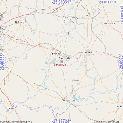
Secunda GPS coordinates[2]
26° 33' 0" South, 29° 10' 0.012" East
| Map corner | latitude | longitude |
|---|---|---|
| Upper-left | -25.91931°, | 28.46355° |
| Center: | -26.55°, | 29.16667° |
| Lower-right: | -27.17724°, | 29.8698° |
| Map W x H: | 139.9×139.9 km | = 86.9×86.9mi |
| max Lat: | -22.34881° ⇑27.1% North |
| Secunda: | -26.55° |
| min Lat: | ⇓72.9% South -34.66739° |
| min Long | Secunda | max Long |
| 16.8697° | 29.16667° | 32.26762° |
| W 70.8%⇐ | ⇒29.2% E |
Elevation
Elevation of Secunda is 1592 m = 5223 ft, and this is 622.4 m = 2042 ft above average elevation for this country.
| Max E: |
1873 m = 6145 ft | 11.8% |
| Secunda | 1592 m 5223 ft | |
| Avg. | 969.6 m = 3181 ft | |
Min E: |
7 m = 23 ft | 88.2% |
See also: South Africa elevation on elevation.city.
Geographical zone
Secunda is located in South temperate zone (between Tropic of Capricorn and the Antarctic Circle). Distance of this Southern Tropic circle is 346.2 km =215.1 mi to North.| Distance of | km | miles | from Secunda |
|---|---|---|---|
| Equator | 2952.1 | 1834.3 | to North |
| Tropic Capricorn | 346.2 | 215.1 | to North |
| Antarctic Circle | 4449.1 | 2764.5 | to South |
| South Pole | 7055 | 4383.8 | to South |


Nearby cities:
15 places around Secunda: (largest is in red/bold)
• Balfour
58.7 km =36.5 mi,  257°
257°
• Bethal
31.5 km =19.6 mi,  71°
71°
• Brakpan
86.7 km =53.9 mi,  293°
293°
• Breyten
86.2 km =53.6 mi, 71°
• Delmas
65.8 km =40.9 mi,  312°
312°
• Ermelo
81.3 km =50.5 mi,  88°
88°
• Heidelberg
80.5 km =50 mi,  273°
273°
• Hendrina
69.9 km =43.4 mi,  51°
51°
• Kriel
31.2 km =19.4 mi,  10°
10°
• Nigel
69.9 km =43.4 mi,  280°
280°
• Springs
83.3 km =51.8 mi, 293°
• Standerton
43.3 km =26.9 mi,  170°
170°
• Villiers
77.5 km =48.2 mi,  226°
226°
• Witbank
75.8 km =47.1 mi, 5°
• eMbalenhle
10.1 km =6.3 mi, 280°
Sources, notices
• [Note1] Compared only with cities in South Africa existing in our database
• [Src1] Map data: © OpenStreetMap contributors (CC-BY-SA)
• [Src2] Other city data from geonames.org with taken over terms of usage.
• [Src3] Geographical zone / Annual Mean Temperature by Robert A. Rohde @ Wikipedia
