Belfast geodata
Belfast (Mpumalanga) is a seat of a third-order administrative division; located in South Africa in Africa/Johannesburg (GMT+2) time zone. With population of 11,916 people, there are 198 cities with bigger population in this country. Compared to other cities in South Africa, 87.6% of cities are located further ↓South; 80.5% of cities are located further ←West and 100% of cities have lower elevation than Belfast. Note1
Administrative division(s):
- Level 1: Mpumalanga
- Level 2: Nkangala District Municipality
- Level 3: Emakhazeni


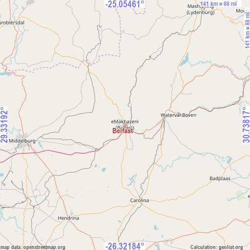
Belfast GPS coordinates[2]
25° 41' 23.676" South, 30° 2' 6.144" East
| Map corner | latitude | longitude |
|---|---|---|
| Upper-left | -25.05461°, | 29.33192° |
| Center: | -25.68991°, | 30.03504° |
| Lower-right: | -26.32184°, | 30.73817° |
| Map W x H: | 140.9×140.9 km | = 87.6×87.6mi |
| max Lat: | -22.34881° ⇑12.4% North |
| Belfast: | -25.68991° |
| min Lat: | ⇓87.6% South -34.66739° |
| min Long | Belfast | max Long |
| 16.8697° | 30.03504° | 32.26762° |
| W 80.5%⇐ | ⇒19.5% E |
Elevation
Elevation of Belfast is 1873 m = 6145 ft, and this is 903.4 m = 2964 ft above average elevation for this country.
| Max E: |
1873 m = 6145 ft | 0% |
| Belfast | 1873 m 6145 ft | |
| Avg. | 969.6 m = 3181 ft | |
Min E: |
7 m = 23 ft | 100% |
See also: South Africa elevation on elevation.city.
Geographical zone
Belfast is located in South temperate zone (between Tropic of Capricorn and the Antarctic Circle). Distance of this Southern Tropic circle is 250.5 km =155.7 mi to North.| Distance of | km | miles | from Belfast |
|---|---|---|---|
| Equator | 2856.5 | 1774.9 | to North |
| Tropic Capricorn | 250.5 | 155.7 | to North |
| Antarctic Circle | 4544.7 | 2823.9 | to South |
| South Pole | 7150.6 | 4443.2 | to South |


Nearby cities:
15 places around Belfast: (largest is in red/bold)
• Barberton
102.6 km =63.8 mi,  96°
96°
• Bethal
102.6 km =63.8 mi,  213°
213°
• Breyten
68.2 km =42.4 mi,  184°
184°
• Carolina
42.9 km =26.7 mi,  169°
169°
• Ermelo
93.9 km =58.3 mi, 183°
• Groblersdal
86.6 km =53.8 mi,  312°
312°
• Hendrina
61.2 km =38 mi, 211°
• Jane Furse
104.7 km =65.1 mi,  350°
350°
• Kriel
103.8 km =64.5 mi,  231°
231°
• Lydenburg
77.8 km =48.3 mi,  31°
31°
• Marble Hall
109.9 km =68.3 mi,  317°
317°
• Middelburg
57.9 km =36 mi,  260°
260°
• Nelspruit
96.8 km =60.1 mi,  75°
75°
• White River
105.8 km =65.7 mi,  67°
67°
• Witbank
82.8 km =51.4 mi, 255°
Sources, notices
• [Note1] Compared only with cities in South Africa existing in our database
• [Src1] Map data: © OpenStreetMap contributors (CC-BY-SA)
• [Src2] Other city data from geonames.org with taken over terms of usage.
• [Src3] Geographical zone / Annual Mean Temperature by Robert A. Rohde @ Wikipedia
