Hendrina geodata
Hendrina (Mpumalanga) is a populated place; located in South Africa in Africa/Johannesburg (GMT+2) time zone. With population of 15,871 people, there are 164 cities with bigger population in this country. Compared to other cities in South Africa, 79.9% of cities are located further ↓South; 75.8% of cities are located further ←West and 97.1% of cities have lower elevation than Hendrina. Note1
Administrative division(s):
- Level 1: Mpumalanga
- Level 2: Nkangala District Municipality
- Level 3: Steve Tshwete


Hendrina GPS coordinates[2]
26° 9' 31.716" South, 29° 42' 55.008" East
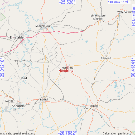
| Map corner | latitude | longitude |
|---|---|---|
| Upper-left | -25.526°, | 29.01216° |
| Center: | -26.15881°, | 29.71528° |
| Lower-right: | -26.7882°, | 30.41841° |
| Map W x H: | 140.3×140.3 km | = 87.2×87.2mi |
| max Lat: | -22.34881° ⇑20.1% North |
| Hendrina: | -26.15881° |
| min Lat: | ⇓79.9% South -34.66739° |
| min Long | Hendrina | max Long |
| 16.8697° | 29.71528° | 32.26762° |
| W 75.8%⇐ | ⇒24.2% E |
Elevation
Elevation of Hendrina is 1686 m = 5531 ft, and this is 716.4 m = 2350 ft above average elevation for this country.
| Max E: |
1873 m = 6145 ft | 2.9% |
| Hendrina | 1686 m 5531 ft | |
| Avg. | 969.6 m = 3181 ft | |
Min E: |
7 m = 23 ft | 97.1% |
See also: South Africa elevation on elevation.city.
Geographical zone
Hendrina is located in South temperate zone (between Tropic of Capricorn and the Antarctic Circle). Distance of this Southern Tropic circle is 302.7 km =188.1 mi to North.| Distance of | km | miles | from Hendrina |
|---|---|---|---|
| Equator | 2908.6 | 1807.3 | to North |
| Tropic Capricorn | 302.7 | 188.1 | to North |
| Antarctic Circle | 4492.6 | 2791.6 | to South |
| South Pole | 7098.5 | 4410.8 | to South |


Nearby cities:
15 places around Hendrina: (largest is in red/bold)
• Belfast
61.2 km =38 mi,  31°
31°
• Bethal
41.5 km =25.8 mi,  216°
216°
• Breyten
31.4 km =19.5 mi,  120°
120°
• Bronkhorstspruit
104.7 km =65.1 mi,  291°
291°
• Carolina
41.1 km =25.5 mi,  75°
75°
• Delmas
103 km =64 mi,  270°
270°
• Ekangala
109.4 km =68 mi,  298°
298°
• Ermelo
49.5 km =30.8 mi,  147°
147°
• Groblersdal
114.7 km =71.3 mi,  343°
343°
• Kriel
50.5 km =31.4 mi,  255°
255°
• Middelburg
49.5 km =30.8 mi,  329°
329°
• Secunda
69.9 km =43.4 mi,  231°
231°
• Standerton
98.2 km =61 mi,  208°
208°
• Witbank
57.8 km =35.9 mi, 303°
• eMbalenhle
76.9 km =47.8 mi,  237°
237°
Sources, notices
• [Note1] Compared only with cities in South Africa existing in our database
• [Src1] Map data: © OpenStreetMap contributors (CC-BY-SA)
• [Src2] Other city data from geonames.org with taken over terms of usage.
• [Src3] Geographical zone / Annual Mean Temperature by Robert A. Rohde @ Wikipedia
