Willowmore geodata
Willowmore (Eastern Cape) is a seat of a third-order administrative division; located in South Africa in Africa/Johannesburg (GMT+2) time zone. With population of 7,100 people, there are 228 cities with bigger population in this country. Compared to other cities in South Africa, 86.4% of cities are located further ↑North; 80.2% of cities are located further →East and 64.9% of cities have higher elevation than Willowmore. Note1
Administrative division(s):
- Level 1: Eastern Cape
- Level 2: Cacadu District Municipality
- Level 3: Baviaans


Willowmore GPS coordinates[2]
33° 17' 33.54" South, 23° 29' 22.344" East
| Map corner | latitude | longitude |
|---|---|---|
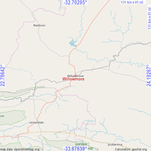
| Upper-left | -32.70295°, | 22.78642° |
| Center: | -33.29265°, | 23.48954° |
| Lower-right: | -33.87839°, | 24.19267° |
| Map W x H: | 130.7×130.7 km | = 81.2×81.2mi |
| max Lat: | -22.34881° ⇑86.4% North |
| Willowmore: | -33.29265° |
| min Lat: | ⇓13.6% South -34.66739° |
| min Long | Willowmore | max Long |
| 16.8697° | 23.48954° | 32.26762° |
| W 19.8%⇐ | ⇒80.2% E |
Elevation
Elevation of Willowmore is 828 m = 2717 ft, and this is 141.6 m = 465 ft below average elevation for this country.
| Max E: |
1873 m = 6145 ft | 64.9% |
| Avg. | 969.6 m = 3181 ft | |
| Willowmore | 828 m = 2717 ft | |
Min E: |
7 m = 23 ft | 35.1% |
See also: South Africa elevation on elevation.city.
Geographical zone
Willowmore is located in South temperate zone (between Tropic of Capricorn and the Antarctic Circle). Distance of this Southern Tropic circle is 1095.9 km =681 mi to North.| Distance of | km | miles | from Willowmore |
|---|---|---|---|
| Equator | 3701.8 | 2300.2 | to North |
| Tropic Capricorn | 1095.9 | 681 | to North |
| Antarctic Circle | 3699.4 | 2298.7 | to South |
| South Pole | 6305.3 | 3917.9 | to South |


Nearby cities:
15 places around Willowmore: (largest is in red/bold)
• Beaufort West
134.2 km =83.4 mi,  320°
320°
• Calitzdorp
170.3 km =105.8 mi,  261°
261°
• De Rust
91.3 km =56.7 mi, 256°
• George
120.9 km =75.1 mi,  231°
231°
• Graaff-Reinet
151.2 km =94 mi,  40°
40°
• Jansenville
116.8 km =72.6 mi,  70°
70°
• Kareedouw
104.3 km =64.8 mi,  134°
134°
• Kirkwood
181.8 km =113 mi,  93°
93°
• Knysna
92.3 km =57.4 mi,  206°
206°
• Kruisfontein
139.5 km =86.7 mi,  124°
124°
• Mossel Bay
158.8 km =98.7 mi, 231°
• Oudtshoorn
124.5 km =77.4 mi,  254°
254°
• Plettenberg Bay
85.2 km =52.9 mi,  187°
187°
• Prince Albert
136.2 km =84.6 mi,  273°
273°
• Uitenhage
184.2 km =114.5 mi,  106°
106°
Sources, notices
• [Note1] Compared only with cities in South Africa existing in our database
• [Src1] Map data: © OpenStreetMap contributors (CC-BY-SA)
• [Src2] Other city data from geonames.org with taken over terms of usage.
• [Src3] Geographical zone / Annual Mean Temperature by Robert A. Rohde @ Wikipedia
