Kruisfontein geodata
Kruisfontein (Eastern Cape) is a populated place; located in South Africa in Africa/Johannesburg (GMT+2) time zone. With population of 18,991 people, there are 149 cities with bigger population in this country. Compared to other cities in South Africa, 95.9% of cities are located further ↑North; 75.8% of cities are located further →East and 82.6% of cities have higher elevation than Kruisfontein. Note1
Administrative division(s):
- Level 1: Eastern Cape
- Level 2: Cacadu District Municipality
- Level 3: Kouga


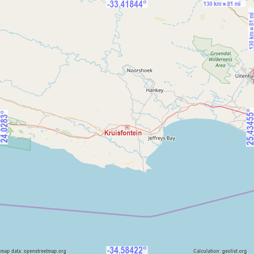
Kruisfontein GPS coordinates[2]
34° 0' 11.988" South, 24° 43' 53.112" East
| Map corner | latitude | longitude |
|---|---|---|
| Upper-left | -33.41844°, | 24.0283° |
| Center: | -34.00333°, | 24.73142° |
| Lower-right: | -34.58422°, | 25.43455° |
| Map W x H: | 129.6×129.6 km | = 80.5×80.5mi |
| max Lat: | -22.34881° ⇑95.9% North |
| Kruisfontein: | -34.00333° |
| min Lat: | ⇓4.1% South -34.66739° |
| min Long | Kruisfontein | max Long |
| 16.8697° | 24.73142° | 32.26762° |
| W 24.2%⇐ | ⇒75.8% E |
Elevation
Elevation of Kruisfontein is 228 m = 748 ft, and this is 741.6 m = 2433 ft below average elevation for this country.
| Max E: |
1873 m = 6145 ft | 82.6% |
| Avg. | 969.6 m = 3181 ft | |
| Kruisfontein | 228 m = 748 ft | |
Min E: |
7 m = 23 ft | 17.4% |
See also: South Africa elevation on elevation.city.
Geographical zone
Kruisfontein is located in South temperate zone (between Tropic of Capricorn and the Antarctic Circle). Distance of this Southern Tropic circle is 1174.9 km =730 mi to North.| Distance of | km | miles | from Kruisfontein |
|---|---|---|---|
| Equator | 3780.8 | 2349.3 | to North |
| Tropic Capricorn | 1174.9 | 730 | to North |
| Antarctic Circle | 3620.4 | 2249.6 | to South |
| South Pole | 6226.2 | 3868.8 | to South |


Nearby cities:
15 places around Kruisfontein: (largest is in red/bold)
• Adelaide
204.6 km =127.1 mi,  45°
45°
• De Rust
210.9 km =131 mi,  285°
285°
• George
209.3 km =130.1 mi,  271°
271°
• Graaff-Reinet
195.6 km =121.5 mi,  354°
354°
• Grahamstown
183.9 km =114.3 mi,  65°
65°
• Jansenville
118 km =73.3 mi,  357°
357°
• Kareedouw
41 km =25.5 mi,  277°
277°
• Kirkwood
94.1 km =58.5 mi,  44°
44°
• Knysna
155.3 km =96.5 mi, 268°
• Plettenberg Bay
125.4 km =77.9 mi, 267°
• Port Alfred
204.2 km =126.9 mi,  76°
76°
• Port Elizabeth
81.6 km =50.7 mi,  86°
86°
• Somerset East
163.2 km =101.4 mi,  29°
29°
• Uitenhage
67.3 km =41.8 mi, 66°
• Willowmore
139.5 km =86.7 mi,  304°
304°
Sources, notices
• [Note1] Compared only with cities in South Africa existing in our database
• [Src1] Map data: © OpenStreetMap contributors (CC-BY-SA)
• [Src2] Other city data from geonames.org with taken over terms of usage.
• [Src3] Geographical zone / Annual Mean Temperature by Robert A. Rohde @ Wikipedia
