Williston geodata
Williston (Northern Cape) is a seat of a third-order administrative division; located in South Africa in Africa/Johannesburg (GMT+2) time zone. In our database, there are 257 cities with bigger population. Compared to other cities in South Africa, 74.6% of cities are located further ↑North; 87.6% of cities are located further →East and 52.8% of cities have higher elevation than Williston. Note1
Administrative division(s):
- Level 1: Northern Cape
- Level 2: Namakwa District Municipality
- Level 3: Karoo Hoogland


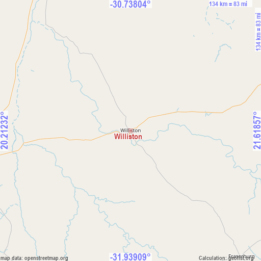
Williston GPS coordinates[2]
31° 20' 25.728" South, 20° 54' 55.584" East
| Map corner | latitude | longitude |
|---|---|---|
| Upper-left | -30.73804°, | 20.21232° |
| Center: | -31.34048°, | 20.91544° |
| Lower-right: | -31.93909°, | 21.61857° |
| Map W x H: | 133.5×133.5 km | = 83×83mi |
| max Lat: | -22.34881° ⇑74.6% North |
| Williston: | -31.34048° |
| min Lat: | ⇓25.4% South -34.66739° |
| min Long | Williston | max Long |
| 16.8697° | 20.91544° | 32.26762° |
| W 12.4%⇐ | ⇒87.6% E |
Elevation
Elevation of Williston is 1078 m = 3537 ft, and this is 108.4 m = 356 ft above average elevation for this country.
| Max E: |
1873 m = 6145 ft | 52.8% |
| Williston | 1078 m 3537 ft | |
| Avg. | 969.6 m = 3181 ft | |
Min E: |
7 m = 23 ft | 47.2% |
See also: South Africa elevation on elevation.city.
Geographical zone
Williston is located in South temperate zone (between Tropic of Capricorn and the Antarctic Circle). Distance of this Southern Tropic circle is 878.8 km =546.1 mi to North.| Distance of | km | miles | from Williston |
|---|---|---|---|
| Equator | 3484.7 | 2165.3 | to North |
| Tropic Capricorn | 878.8 | 546.1 | to North |
| Antarctic Circle | 3916.4 | 2433.5 | to South |
| South Pole | 6522.3 | 4052.8 | to South |


Nearby cities:
15 places around Williston: (largest is in red/bold)
• Beaufort West
193.8 km =120.4 mi,  125°
125°
• Brandvlei
105.6 km =65.6 mi,  337°
337°
• Calitzdorp
253.4 km =157.5 mi,  163°
163°
• Calvinia
109.1 km =67.8 mi,  262°
262°
• Carnarvon
123 km =76.4 mi,  70°
70°
• Clanwilliam
212.9 km =132.3 mi,  243°
243°
• Fraserburg
85.4 km =53.1 mi,  138°
138°
• Kenhardt
223 km =138.6 mi,  5°
5°
• Ladismith
241.6 km =150.1 mi,  172°
172°
• Laingsburg
206.3 km =128.2 mi,  181°
181°
• Prince Albert
234.1 km =145.5 mi,  153°
153°
• Van Wyksvlei
140.2 km =87.1 mi,  38°
38°
• Victoria West
208.9 km =129.8 mi,  91°
91°
• Vredendal
231.8 km =144 mi, 260°
• Zoar
244.7 km =152 mi, 168°
Sources, notices
• [Note1] Compared only with cities in South Africa existing in our database
• [Src1] Map data: © OpenStreetMap contributors (CC-BY-SA)
• [Src2] Other city data from geonames.org with taken over terms of usage.
• [Src3] Geographical zone / Annual Mean Temperature by Robert A. Rohde @ Wikipedia
