Fraserburg geodata
Fraserburg (Northern Cape) is a populated place; located in South Africa in Africa/Johannesburg (GMT+2) time zone. With population of 3,029 people, there are 245 cities with bigger population in this country. Compared to other cities in South Africa, 78.8% of cities are located further ↑North; 85.8% of cities are located further →East and 61.4% of cities have lower elevation than Fraserburg. Note1
Administrative division(s):
- Level 1: Northern Cape
- Level 2: Namakwa District Municipality
- Level 3: Karoo Hoogland


Fraserburg GPS coordinates[2]
31° 54' 56.376" South, 21° 30' 48.06" East
| Map corner | latitude | longitude |
|---|---|---|
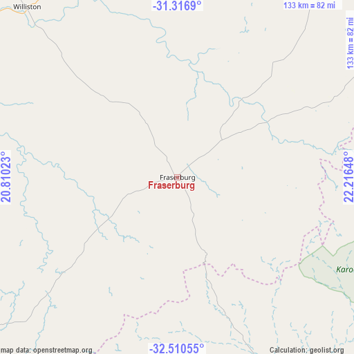
| Upper-left | -31.3169°, | 20.81023° |
| Center: | -31.91566°, | 21.51335° |
| Lower-right: | -32.51055°, | 22.21648° |
| Map W x H: | 132.7×132.7 km | = 82.5×82.5mi |
| max Lat: | -22.34881° ⇑78.8% North |
| Fraserburg: | -31.91566° |
| min Lat: | ⇓21.2% South -34.66739° |
| min Long | Fraserburg | max Long |
| 16.8697° | 21.51335° | 32.26762° |
| W 14.2%⇐ | ⇒85.8% E |
Elevation
Elevation of Fraserburg is 1262 m = 4140 ft, and this is 292.4 m = 959 ft above average elevation for this country.
| Max E: |
1873 m = 6145 ft | 38.6% |
| Fraserburg | 1262 m 4140 ft | |
| Avg. | 969.6 m = 3181 ft | |
Min E: |
7 m = 23 ft | 61.4% |
See also: South Africa elevation on elevation.city.
Geographical zone
Fraserburg is located in South temperate zone (between Tropic of Capricorn and the Antarctic Circle). Distance of this Southern Tropic circle is 942.8 km =585.8 mi to North.| Distance of | km | miles | from Fraserburg |
|---|---|---|---|
| Equator | 3548.7 | 2205.1 | to North |
| Tropic Capricorn | 942.8 | 585.8 | to North |
| Antarctic Circle | 3852.5 | 2393.8 | to South |
| South Pole | 6458.4 | 4013.1 | to South |


Nearby cities:
15 places around Fraserburg: (largest is in red/bold)
• Beaufort West
112 km =69.6 mi,  115°
115°
• Brandvlei
188.5 km =117.1 mi,  328°
328°
• Calitzdorp
179.9 km =111.8 mi,  175°
175°
• Calvinia
171.6 km =106.6 mi,  286°
286°
• Carnarvon
120.6 km =74.9 mi,  29°
29°
• De Rust
199.5 km =124 mi,  151°
151°
• Hardys Memories of Africa
233.4 km =145 mi,  198°
198°
• Ladismith
176.9 km =109.9 mi,  187°
187°
• Laingsburg
154.9 km =96.3 mi, 203°
• Oudtshoorn
198 km =123 mi,  161°
161°
• Prince Albert
153.3 km =95.3 mi, 161°
• Van Wyksvlei
176.5 km =109.7 mi,  9°
9°
• Victoria West
161.9 km =100.6 mi,  69°
69°
• Williston
85.4 km =53.1 mi,  318°
318°
• Zoar
175.8 km =109.2 mi, 182°
Sources, notices
• [Note1] Compared only with cities in South Africa existing in our database
• [Src1] Map data: © OpenStreetMap contributors (CC-BY-SA)
• [Src2] Other city data from geonames.org with taken over terms of usage.
• [Src3] Geographical zone / Annual Mean Temperature by Robert A. Rohde @ Wikipedia
