Van Wyksvlei geodata
Van Wyksvlei (Northern Cape) is a populated place; located in South Africa in Africa/Johannesburg (GMT+2) time zone. With population of 1,721 people, there are 251 cities with bigger population in this country. Compared to other cities in South Africa, 67.8% of cities are located further ↑North; 85% of cities are located further →East and 58.7% of cities have higher elevation than Van Wyksvlei. Note1
Administrative division(s):
- Level 1: Northern Cape
- Level 2: Pixley ka Seme District Municipality
- Level 3: Kareeberg


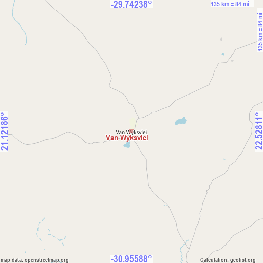
Van Wyksvlei GPS coordinates[2]
30° 21' 3.636" South, 21° 49' 29.928" East
| Map corner | latitude | longitude |
|---|---|---|
| Upper-left | -29.74238°, | 21.12186° |
| Center: | -30.35101°, | 21.82498° |
| Lower-right: | -30.95588°, | 22.52811° |
| Map W x H: | 134.9×134.9 km | = 83.8×83.8mi |
| max Lat: | -22.34881° ⇑67.8% North |
| Van Wyksvlei: | -30.35101° |
| min Lat: | ⇓32.2% South -34.66739° |
| min Long | Van Wyksvlei | max Long |
| 16.8697° | 21.82498° | 32.26762° |
| W 15%⇐ | ⇒85% E |
Elevation
Elevation of Van Wyksvlei is 962 m = 3156 ft, and this is 7.6 m = 25 ft below average elevation for this country.
| Max E: |
1873 m = 6145 ft | 58.7% |
| Avg. | 969.6 m = 3181 ft | |
| Van Wyksvlei | 962 m = 3156 ft | |
Min E: |
7 m = 23 ft | 41.3% |
See also: South Africa elevation on elevation.city.
Geographical zone
Van Wyksvlei is located in South temperate zone (between Tropic of Capricorn and the Antarctic Circle). Distance of this Southern Tropic circle is 768.8 km =477.7 mi to North.| Distance of | km | miles | from Van Wyksvlei |
|---|---|---|---|
| Equator | 3374.7 | 2096.9 | to North |
| Tropic Capricorn | 768.8 | 477.7 | to North |
| Antarctic Circle | 4026.5 | 2502 | to South |
| South Pole | 6632.3 | 4121.1 | to South |


Nearby cities:
15 places around Van Wyksvlei: (largest is in red/bold)
• Beaufort West
234.3 km =145.6 mi,  162°
162°
• Brandvlei
129 km =80.2 mi,  264°
264°
• Calvinia
231.7 km =144 mi,  237°
237°
• Carnarvon
74.7 km =46.4 mi, 156°
• De Aar
212.2 km =131.9 mi,  99°
99°
• Douglas
237.1 km =147.3 mi,  52°
52°
• Fraserburg
176.5 km =109.7 mi,  189°
189°
• Groblershoop
162.6 km =101 mi,  5°
5°
• Hopetown
232.2 km =144.3 mi,  69°
69°
• Kakamas
210.9 km =131 mi,  326°
326°
• Kenhardt
129 km =80.2 mi, 330°
• Prieska
116.5 km =72.4 mi, 49°
• Upington
218.7 km =135.9 mi,  345°
345°
• Victoria West
169.8 km =105.5 mi,  133°
133°
• Williston
140.2 km =87.1 mi,  218°
218°
Sources, notices
• [Note1] Compared only with cities in South Africa existing in our database
• [Src1] Map data: © OpenStreetMap contributors (CC-BY-SA)
• [Src2] Other city data from geonames.org with taken over terms of usage.
• [Src3] Geographical zone / Annual Mean Temperature by Robert A. Rohde @ Wikipedia
