Kenhardt geodata
Kenhardt (Northern Cape) is a populated place; located in South Africa in Africa/Johannesburg (GMT+2) time zone. With population of 4,842 people, there are 236 cities with bigger population in this country. Compared to other cities in South Africa, 59.3% of cities are located further ↑North; 87.3% of cities are located further →East and 65.8% of cities have higher elevation than Kenhardt. Note1
Administrative division(s):
- Level 1: Northern Cape
- Level 2: Siyanda District Municipality
- Level 3: Kai !Garib


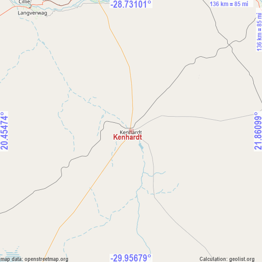
Kenhardt GPS coordinates[2]
29° 20' 44.664" South, 21° 9' 28.296" East
| Map corner | latitude | longitude |
|---|---|---|
| Upper-left | -28.73101°, | 20.45474° |
| Center: | -29.34574°, | 21.15786° |
| Lower-right: | -29.95679°, | 21.86099° |
| Map W x H: | 136.3×136.3 km | = 84.7×84.7mi |
| max Lat: | -22.34881° ⇑59.3% North |
| Kenhardt: | -29.34574° |
| min Lat: | ⇓40.7% South -34.66739° |
| min Long | Kenhardt | max Long |
| 16.8697° | 21.15786° | 32.26762° |
| W 12.7%⇐ | ⇒87.3% E |
Elevation
Elevation of Kenhardt is 805 m = 2641 ft, and this is 164.6 m = 540 ft below average elevation for this country.
| Max E: |
1873 m = 6145 ft | 65.8% |
| Avg. | 969.6 m = 3181 ft | |
| Kenhardt | 805 m = 2641 ft | |
Min E: |
7 m = 23 ft | 34.2% |
See also: South Africa elevation on elevation.city.
Geographical zone
Kenhardt is located in South temperate zone (between Tropic of Capricorn and the Antarctic Circle). Distance of this Southern Tropic circle is 657 km =408.2 mi to North.| Distance of | km | miles | from Kenhardt |
|---|---|---|---|
| Equator | 3262.9 | 2027.5 | to North |
| Tropic Capricorn | 657 | 408.2 | to North |
| Antarctic Circle | 4138.2 | 2571.4 | to South |
| South Pole | 6744.1 | 4190.6 | to South |


Nearby cities:
15 places around Kenhardt: (largest is in red/bold)
• Brandvlei
140.3 km =87.2 mi,  207°
207°
• Calvinia
270.9 km =168.3 mi, 209°
• Carnarvon
203.3 km =126.3 mi,  152°
152°
• Daniëlskuil
265.4 km =164.9 mi,  61°
61°
• Douglas
256 km =159.1 mi,  82°
82°
• Groblershoop
94.6 km =58.8 mi, 58°
• Hopetown
285 km =177.1 mi,  96°
96°
• Kakamas
82.7 km =51.4 mi,  320°
320°
• Kathu
260.4 km =161.8 mi,  45°
45°
• Pofadder
172.7 km =107.3 mi,  278°
278°
• Postmasburg
217.2 km =135 mi, 58°
• Prieska
157.5 km =97.9 mi, 103°
• Upington
100.3 km =62.3 mi,  5°
5°
• Van Wyksvlei
129 km =80.2 mi, 150°
• Williston
223 km =138.6 mi,  185°
185°
Sources, notices
• [Note1] Compared only with cities in South Africa existing in our database
• [Src1] Map data: © OpenStreetMap contributors (CC-BY-SA)
• [Src2] Other city data from geonames.org with taken over terms of usage.
• [Src3] Geographical zone / Annual Mean Temperature by Robert A. Rohde @ Wikipedia
