Ganyesa geodata
Ganyesa (North-West) is a seat of a third-order administrative division; located in South Africa in Africa/Johannesburg (GMT+2) time zone. In our database, there are 257 cities with bigger population. Compared to other cities in South Africa, 72.3% of cities are located further ↓South; 78.8% of cities are located further →East and 62.5% of cities have lower elevation than Ganyesa. Note1
Administrative division(s):
- Level 1: North-West
- Level 2: Dr Ruth Segomotsi Mompati District Municipality
- Level 3: Kagisano/Molopo


Ganyesa GPS coordinates[2]
26° 35' 46.068" South, 24° 10' 34.032" East
| Map corner | latitude | longitude |
|---|---|---|
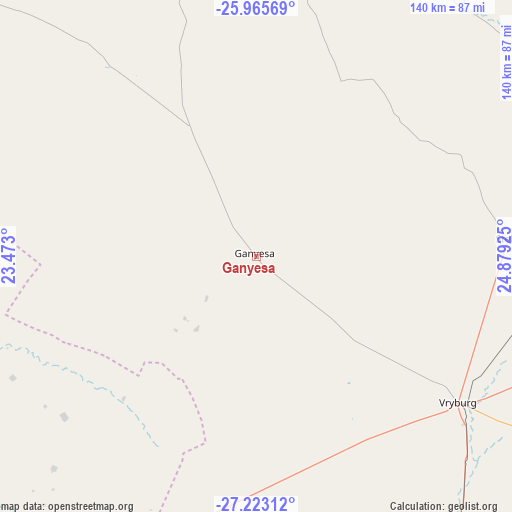
| Upper-left | -25.96569°, | 23.473° |
| Center: | -26.59613°, | 24.17612° |
| Lower-right: | -27.22312°, | 24.87925° |
| Map W x H: | 139.8×139.8 km | = 86.9×86.9mi |
| max Lat: | -22.34881° ⇑27.7% North |
| Ganyesa: | -26.59613° |
| min Lat: | ⇓72.3% South -34.66739° |
| min Long | Ganyesa | max Long |
| 16.8697° | 24.17612° | 32.26762° |
| W 21.2%⇐ | ⇒78.8% E |
Elevation
Elevation of Ganyesa is 1282 m = 4206 ft, and this is 312.4 m = 1025 ft above average elevation for this country.
| Max E: |
1873 m = 6145 ft | 37.5% |
| Ganyesa | 1282 m 4206 ft | |
| Avg. | 969.6 m = 3181 ft | |
Min E: |
7 m = 23 ft | 62.5% |
See also: South Africa elevation on elevation.city.
Geographical zone
Ganyesa is located in South temperate zone (between Tropic of Capricorn and the Antarctic Circle). Distance of this Southern Tropic circle is 351.3 km =218.3 mi to North.| Distance of | km | miles | from Ganyesa |
|---|---|---|---|
| Equator | 2957.2 | 1837.5 | to North |
| Tropic Capricorn | 351.3 | 218.3 | to North |
| Antarctic Circle | 4444 | 2761.4 | to South |
| South Pole | 7049.8 | 4380.5 | to South |


Nearby cities:
15 places around Ganyesa: (largest is in red/bold)
• Bloemhof
183.6 km =114.1 mi,  129°
129°
• Christiana
175.9 km =109.3 mi,  146°
146°
• Daniëlskuil
187.9 km =116.8 mi,  199°
199°
• Delareyville
127.9 km =79.5 mi,  94°
94°
• Hartswater
142.2 km =88.4 mi, 154°
• Jan Kempdorp
161 km =100 mi,  156°
156°
• Kathu
165.5 km =102.8 mi,  222°
222°
• Kuruman
120.4 km =74.8 mi, 217°
• Mahikeng
167.5 km =104.1 mi,  60°
60°
• Mmabatho
167.4 km =104 mi, 60°
• Pampierstad
141.4 km =87.9 mi, 159°
• Schweizer-Reneke
132 km =82 mi,  119°
119°
• Taung
120.3 km =74.8 mi, 149°
• Vryburg
67.9 km =42.2 mi, 126°
• Warrenton
181.3 km =112.7 mi, 158°
Sources, notices
• [Note1] Compared only with cities in South Africa existing in our database
• [Src1] Map data: © OpenStreetMap contributors (CC-BY-SA)
• [Src2] Other city data from geonames.org with taken over terms of usage.
• [Src3] Geographical zone / Annual Mean Temperature by Robert A. Rohde @ Wikipedia
