Jan Kempdorp geodata
Jan Kempdorp (North-West) is a populated place; located in South Africa in Africa/Johannesburg (GMT+2) time zone. With population of 13,485 people, there are 179 cities with bigger population in this country. Compared to other cities in South Africa, 57.8% of cities are located further ↓South; 74.6% of cities are located further →East and 53.1% of cities have lower elevation than Jan Kempdorp. Note1


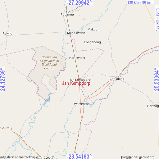
Jan Kempdorp GPS coordinates[2]
27° 55' 20.856" South, 24° 49' 49.836" East
| Map corner | latitude | longitude |
|---|---|---|
| Upper-left | -27.29942°, | 24.12739° |
| Center: | -27.92246°, | 24.83051° |
| Lower-right: | -28.54193°, | 25.53364° |
| Map W x H: | 138.2×138.2 km | = 85.9×85.9mi |
| max Lat: | -22.34881° ⇑42.2% North |
| Jan Kempdorp: | -27.92246° |
| min Lat: | ⇓57.8% South -34.66739° |
| min Long | Jan Kempdorp | max Long |
| 16.8697° | 24.83051° | 32.26762° |
| W 25.4%⇐ | ⇒74.6% E |
Elevation
Elevation of Jan Kempdorp is 1159 m = 3802 ft, and this is 189.4 m = 621 ft above average elevation for this country.
| Max E: |
1873 m = 6145 ft | 46.9% |
| Jan Kempdorp | 1159 m 3802 ft | |
| Avg. | 969.6 m = 3181 ft | |
Min E: |
7 m = 23 ft | 53.1% |
See also: South Africa elevation on elevation.city.
Geographical zone
Jan Kempdorp is located in South temperate zone (between Tropic of Capricorn and the Antarctic Circle). Distance of this Southern Tropic circle is 498.8 km =309.9 mi to North.| Distance of | km | miles | from Jan Kempdorp |
|---|---|---|---|
| Equator | 3104.7 | 1929.2 | to North |
| Tropic Capricorn | 498.8 | 309.9 | to North |
| Antarctic Circle | 4296.5 | 2669.7 | to South |
| South Pole | 6902.4 | 4289 | to South |


Nearby cities:
15 places around Jan Kempdorp: (largest is in red/bold)
• Barkly West
74.6 km =46.4 mi,  203°
203°
• Bloemhof
82.3 km =51.1 mi,  68°
68°
• Boshof
79.4 km =49.3 mi,  149°
149°
• Bultfontein
135.6 km =84.3 mi,  107°
107°
• Christiana
32.5 km =20.2 mi,  88°
88°
• Daniëlskuil
130.1 km =80.8 mi,  256°
256°
• Hartswater
19.5 km =12.1 mi,  350°
350°
• Hoopstad
106.4 km =66.1 mi,  84°
84°
• Kimberley
90.3 km =56.1 mi,  184°
184°
• Pampierstad
20.9 km =13 mi,  317°
317°
• Ritchie
126 km =78.3 mi,  190°
190°
• Schweizer-Reneke
95.3 km =59.2 mi,  31°
31°
• Taung
43.7 km =27.2 mi, 354°
• Vryburg
107.9 km =67 mi, 354°
• Warrenton
21.4 km =13.3 mi, 175°
Sources, notices
• [Note1] Compared only with cities in South Africa existing in our database
• [Src1] Map data: © OpenStreetMap contributors (CC-BY-SA)
• [Src2] Other city data from geonames.org with taken over terms of usage.
• [Src3] Geographical zone / Annual Mean Temperature by Robert A. Rohde @ Wikipedia
