Schweizer-Reneke geodata
Schweizer-Reneke (North-West) is a seat of a third-order administrative division; located in South Africa in Africa/Johannesburg (GMT+2) time zone. With population of 70,214 people, there are 73 cities with bigger population in this country. Compared to other cities in South Africa, 67% of cities are located further ↓South; 72.3% of cities are located further →East and 64.3% of cities have lower elevation than Schweizer-Reneke. Note1
Administrative division(s):
- Level 1: North-West
- Level 2: Dr Ruth Segomotsi Mompati District Municipality
- Level 3: Mamusa


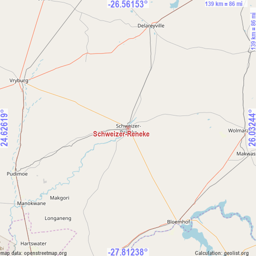
Schweizer-Reneke GPS coordinates[2]
27° 11' 19.356" South, 25° 19' 45.516" East
| Map corner | latitude | longitude |
|---|---|---|
| Upper-left | -26.56153°, | 24.62619° |
| Center: | -27.18871°, | 25.32931° |
| Lower-right: | -27.81238°, | 26.03244° |
| Map W x H: | 139.1×139.1 km | = 86.4×86.4mi |
| max Lat: | -22.34881° ⇑33% North |
| Schweizer-Reneke: | -27.18871° |
| min Lat: | ⇓67% South -34.66739° |
| min Long | Schweizer-Renek | max Long |
| 16.8697° | 25.32931° | 32.26762° |
| W 27.7%⇐ | ⇒72.3% E |
Elevation
Elevation of Schweizer-Reneke is 1312 m = 4304 ft, and this is 342.4 m = 1123 ft above average elevation for this country.
| Max E: |
1873 m = 6145 ft | 35.7% |
| Schweizer-Reneke | 1312 m 4304 ft | |
| Avg. | 969.6 m = 3181 ft | |
Min E: |
7 m = 23 ft | 64.3% |
See also: Schweizer-Reneke elevation on elevation.city.
Geographical zone
Schweizer-Reneke is located in South temperate zone (between Tropic of Capricorn and the Antarctic Circle). Distance of this Southern Tropic circle is 417.2 km =259.2 mi to North.| Distance of | km | miles | from Schweizer-Reneke |
|---|---|---|---|
| Equator | 3023.1 | 1878.5 | to North |
| Tropic Capricorn | 417.2 | 259.2 | to North |
| Antarctic Circle | 4378.1 | 2720.4 | to South |
| South Pole | 6984 | 4339.7 | to South |


Nearby cities:
15 places around Schweizer-Reneke: (largest is in red/bold)
• Bloemhof
57.8 km =35.9 mi,  151°
151°
• Bothaville
129.2 km =80.3 mi,  99°
99°
• Christiana
82.3 km =51.1 mi,  191°
191°
• Delareyville
57.3 km =35.6 mi,  12°
12°
• Ganyesa
132 km =82 mi,  299°
299°
• Hartswater
81.5 km =50.6 mi,  220°
220°
• Hoopstad
91.6 km =56.9 mi,  141°
141°
• Jan Kempdorp
95.3 km =59.2 mi,  211°
211°
• Orkney
135 km =83.9 mi,  80°
80°
• Pampierstad
91.5 km =56.9 mi, 223°
• Taung
65.7 km =40.8 mi,  234°
234°
• Vryburg
64.9 km =40.3 mi,  293°
293°
• Warrenton
113.3 km =70.4 mi,  204°
204°
• Wesselsbron
126.2 km =78.4 mi,  125°
125°
• Wolmaransstad
64.7 km =40.2 mi,  90°
90°
Sources, notices
• [Note1] Compared only with cities in South Africa existing in our database
• [Src1] Map data: © OpenStreetMap contributors (CC-BY-SA)
• [Src2] Other city data from geonames.org with taken over terms of usage.
• [Src3] Geographical zone / Annual Mean Temperature by Robert A. Rohde @ Wikipedia
