De Aar geodata
De Aar (Northern Cape) is a seat of a second-order administrative division; located in South Africa in Africa/Johannesburg (GMT+2) time zone. With population of 32,318 people, there are 119 cities with bigger population in this country. Compared to other cities in South Africa, 69.3% of cities are located further ↑North; 79.4% of cities are located further →East and 59.3% of cities have lower elevation than De Aar. Note1
Administrative division(s):
- Level 1: Northern Cape
- Level 2: Pixley ka Seme District Municipality
- Level 3: Emthanjeni


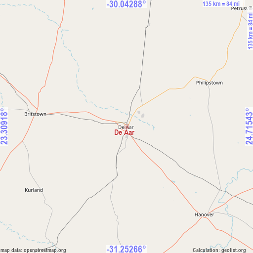
De Aar GPS coordinates[2]
30° 38' 58.776" South, 24° 0' 44.28" East
| Map corner | latitude | longitude |
|---|---|---|
| Upper-left | -30.04288°, | 23.30918° |
| Center: | -30.64966°, | 24.0123° |
| Lower-right: | -31.25266°, | 24.71543° |
| Map W x H: | 134.5×134.5 km | = 83.6×83.6mi |
| max Lat: | -22.34881° ⇑69.3% North |
| De Aar: | -30.64966° |
| min Lat: | ⇓30.7% South -34.66739° |
| min Long | De Aar | max Long |
| 16.8697° | 24.0123° | 32.26762° |
| W 20.6%⇐ | ⇒79.4% E |
Elevation
Elevation of De Aar is 1247 m = 4091 ft, and this is 277.4 m = 910 ft above average elevation for this country.
| Max E: |
1873 m = 6145 ft | 40.7% |
| De Aar | 1247 m 4091 ft | |
| Avg. | 969.6 m = 3181 ft | |
Min E: |
7 m = 23 ft | 59.3% |
See also: South Africa elevation on elevation.city.
Geographical zone
De Aar is located in South temperate zone (between Tropic of Capricorn and the Antarctic Circle). Distance of this Southern Tropic circle is 802 km =498.3 mi to North.| Distance of | km | miles | from De Aar |
|---|---|---|---|
| Equator | 3407.9 | 2117.6 | to North |
| Tropic Capricorn | 802 | 498.3 | to North |
| Antarctic Circle | 3993.3 | 2481.3 | to South |
| South Pole | 6599.1 | 4100.5 | to South |


Nearby cities:
15 places around De Aar: (largest is in red/bold)
• Carnarvon
182.9 km =113.6 mi,  258°
258°
• Colesberg
104 km =64.6 mi,  94°
94°
• Douglas
178.8 km =111.1 mi,  352°
352°
• Graaff-Reinet
184.8 km =114.8 mi,  164°
164°
• Hopetown
114.2 km =71 mi,  3°
3°
• Koffiefontein
167.9 km =104.3 mi,  34°
34°
• Middelburg
133.2 km =82.8 mi,  134°
134°
• Noupoort
107.6 km =66.9 mi,  123°
123°
• Orania
100.6 km =62.5 mi,  22°
22°
• Petrusville
88.6 km =55.1 mi,  44°
44°
• Prieska
163.8 km =101.8 mi,  311°
311°
• Ritchie
188 km =116.8 mi, 17°
• Trompsburg
183 km =113.7 mi,  68°
68°
• Van Wyksvlei
212.2 km =131.9 mi,  279°
279°
• Victoria West
119.8 km =74.4 mi,  225°
225°
Sources, notices
• [Note1] Compared only with cities in South Africa existing in our database
• [Src1] Map data: © OpenStreetMap contributors (CC-BY-SA)
• [Src2] Other city data from geonames.org with taken over terms of usage.
• [Src3] Geographical zone / Annual Mean Temperature by Robert A. Rohde @ Wikipedia
