Prieska geodata
Prieska (Northern Cape) is a seat of a third-order administrative division; located in South Africa in Africa/Johannesburg (GMT+2) time zone. With population of 11,236 people, there are 204 cities with bigger population in this country. Compared to other cities in South Africa, 63.1% of cities are located further ↑North; 82.3% of cities are located further →East and 60.2% of cities have higher elevation than Prieska. Note1
Administrative division(s):
- Level 1: Northern Cape
- Level 2: Pixley ka Seme District Municipality
- Level 3: Siyathemba


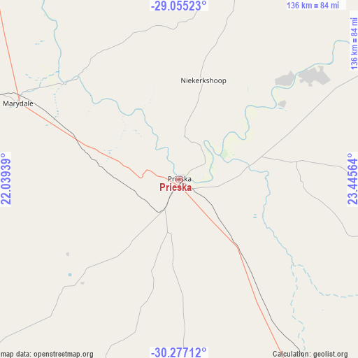
Prieska GPS coordinates[2]
29° 40' 4.908" South, 22° 44' 33.036" East
| Map corner | latitude | longitude |
|---|---|---|
| Upper-left | -29.05523°, | 22.03939° |
| Center: | -29.66803°, | 22.74251° |
| Lower-right: | -30.27712°, | 23.44564° |
| Map W x H: | 135.9×135.9 km | = 84.4×84.4mi |
| max Lat: | -22.34881° ⇑63.1% North |
| Prieska: | -29.66803° |
| min Lat: | ⇓36.9% South -34.66739° |
| min Long | Prieska | max Long |
| 16.8697° | 22.74251° | 32.26762° |
| W 17.7%⇐ | ⇒82.3% E |
Elevation
Elevation of Prieska is 942 m = 3091 ft, and this is 27.6 m = 91 ft below average elevation for this country.
| Max E: |
1873 m = 6145 ft | 60.2% |
| Avg. | 969.6 m = 3181 ft | |
| Prieska | 942 m = 3091 ft | |
Min E: |
7 m = 23 ft | 39.8% |
See also: South Africa elevation on elevation.city.
Geographical zone
Prieska is located in South temperate zone (between Tropic of Capricorn and the Antarctic Circle). Distance of this Southern Tropic circle is 692.9 km =430.5 mi to North.| Distance of | km | miles | from Prieska |
|---|---|---|---|
| Equator | 3298.8 | 2049.8 | to North |
| Tropic Capricorn | 692.9 | 430.5 | to North |
| Antarctic Circle | 4102.4 | 2549.1 | to South |
| South Pole | 6708.3 | 4168.3 | to South |


Nearby cities:
15 places around Prieska: (largest is in red/bold)
• Barkly West
213.8 km =132.8 mi,  53°
53°
• Carnarvon
156 km =96.9 mi,  202°
202°
• Daniëlskuil
181.9 km =113 mi,  25°
25°
• De Aar
163.8 km =101.8 mi,  131°
131°
• Douglas
121 km =75.2 mi,  55°
55°
• Groblershoop
113.1 km =70.3 mi,  319°
319°
• Hopetown
129.8 km =80.7 mi,  87°
87°
• Kenhardt
157.5 km =97.9 mi,  283°
283°
• Orania
162 km =100.7 mi,  95°
95°
• Petrusville
190.4 km =118.3 mi, 103°
• Postmasburg
151.6 km =94.2 mi,  11°
11°
• Ritchie
193.4 km =120.2 mi,  68°
68°
• Upington
198.2 km =123.2 mi,  313°
313°
• Van Wyksvlei
116.5 km =72.4 mi,  229°
229°
• Victoria West
196.2 km =121.9 mi,  169°
169°
Sources, notices
• [Note1] Compared only with cities in South Africa existing in our database
• [Src1] Map data: © OpenStreetMap contributors (CC-BY-SA)
• [Src2] Other city data from geonames.org with taken over terms of usage.
• [Src3] Geographical zone / Annual Mean Temperature by Robert A. Rohde @ Wikipedia
