White River geodata
White River (Mpumalanga) is a populated place; located in South Africa in Africa/Johannesburg (GMT+2) time zone. With population of 15,954 people, there are 163 cities with bigger population in this country. Compared to other cities in South Africa, 90.6% of cities are located further ↓South; 92.6% of cities are located further ←West and 59.9% of cities have higher elevation than White River. Note1


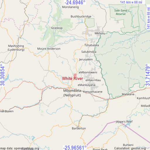
White River GPS coordinates[2]
25° 19' 54.372" South, 31° 0' 41.976" East
| Map corner | latitude | longitude |
|---|---|---|
| Upper-left | -24.6946°, | 30.30854° |
| Center: | -25.33177°, | 31.01166° |
| Lower-right: | -25.96561°, | 31.71479° |
| Map W x H: | 141.3×141.3 km | = 87.8×87.8mi |
| max Lat: | -22.34881° ⇑9.4% North |
| White River: | -25.33177° |
| min Lat: | ⇓90.6% South -34.66739° |
| min Long | White River | max Long |
| 16.8697° | 31.01166° | 32.26762° |
| W 92.6%⇐ | ⇒7.4% E |
Elevation
Elevation of White River is 944 m = 3097 ft, and this is 25.6 m = 84 ft below average elevation for this country.
| Max E: |
1873 m = 6145 ft | 59.9% |
| Avg. | 969.6 m = 3181 ft | |
| White River | 944 m = 3097 ft | |
Min E: |
7 m = 23 ft | 40.1% |
See also: South Africa elevation on elevation.city.
Geographical zone
White River is located in South temperate zone (between Tropic of Capricorn and the Antarctic Circle). Distance of this Southern Tropic circle is 210.7 km =130.9 mi to North.| Distance of | km | miles | from White River |
|---|---|---|---|
| Equator | 2816.6 | 1750.2 | to North |
| Tropic Capricorn | 210.7 | 130.9 | to North |
| Antarctic Circle | 4584.5 | 2848.7 | to South |
| South Pole | 7190.4 | 4467.9 | to South |


Nearby cities:
15 places around White River: (largest is in red/bold)
• Apel
163.1 km =101.3 mi,  308°
308°
• Barberton
50.9 km =31.6 mi,  175°
175°
• Belfast
105.8 km =65.7 mi,  247°
247°
• Breyten
148.8 km =92.5 mi,  223°
223°
• Burgersfort
100.3 km =62.3 mi,  316°
316°
• Carolina
121.6 km =75.6 mi,  227°
227°
• Hendrina
159.1 km =98.9 mi, 234°
• Hoedspruit
109.2 km =67.9 mi,  356°
356°
• Jane Furse
131.4 km =81.6 mi,  298°
298°
• Komatipoort
95.4 km =59.3 mi,  96°
96°
• Lydenburg
62.8 km =39 mi,  294°
294°
• Middelburg
162.8 km =101.2 mi, 252°
• Nelspruit
16.4 km =10.2 mi,  194°
194°
• Phalaborwa
155 km =96.3 mi,  4°
4°
• Thulamahashi
70.1 km =43.6 mi,  15°
15°
Sources, notices
• [Note1] Compared only with cities in South Africa existing in our database
• [Src1] Map data: © OpenStreetMap contributors (CC-BY-SA)
• [Src2] Other city data from geonames.org with taken over terms of usage.
• [Src3] Geographical zone / Annual Mean Temperature by Robert A. Rohde @ Wikipedia
