Lydenburg geodata
Lydenburg (Mpumalanga) is a seat of a third-order administrative division; located in South Africa in Africa/Johannesburg (GMT+2) time zone. With population of 21,695 people, there are 141 cities with bigger population in this country. Compared to other cities in South Africa, 92% of cities are located further ↓South; 86.4% of cities are located further ←West and 70.5% of cities have lower elevation than Lydenburg. Note1


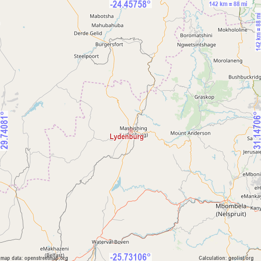
Lydenburg GPS coordinates[2]
25° 5' 45.528" South, 30° 26' 38.148" East
| Map corner | latitude | longitude |
|---|---|---|
| Upper-left | -24.45758°, | 29.74081° |
| Center: | -25.09598°, | 30.44393° |
| Lower-right: | -25.73106°, | 31.14706° |
| Map W x H: | 141.6×141.6 km | = 88×88mi |
| max Lat: | -22.34881° ⇑8% North |
| Lydenburg: | -25.09598° |
| min Lat: | ⇓92% South -34.66739° |
| min Long | Lydenburg | max Long |
| 16.8697° | 30.44393° | 32.26762° |
| W 86.4%⇐ | ⇒13.6% E |
Elevation
Elevation of Lydenburg is 1371 m = 4498 ft, and this is 401.4 m = 1317 ft above average elevation for this country.
| Max E: |
1873 m = 6145 ft | 29.5% |
| Lydenburg | 1371 m 4498 ft | |
| Avg. | 969.6 m = 3181 ft | |
Min E: |
7 m = 23 ft | 70.5% |
See also: South Africa elevation on elevation.city.
Geographical zone
Lydenburg is located in South temperate zone (between Tropic of Capricorn and the Antarctic Circle). Distance of this Southern Tropic circle is 184.5 km =114.6 mi to North.| Distance of | km | miles | from Lydenburg |
|---|---|---|---|
| Equator | 2790.4 | 1733.9 | to North |
| Tropic Capricorn | 184.5 | 114.6 | to North |
| Antarctic Circle | 4610.8 | 2865 | to South |
| South Pole | 7216.7 | 4484.2 | to South |


Nearby cities:
15 places around Lydenburg: (largest is in red/bold)
• Apel
103.2 km =64.1 mi,  317°
317°
• Barberton
98.3 km =61.1 mi,  141°
141°
• Belfast
77.8 km =48.3 mi,  211°
211°
• Burgersfort
48.2 km =30 mi,  346°
346°
• Carolina
113.1 km =70.3 mi,  196°
196°
• Groblersdal
106 km =65.9 mi,  265°
265°
• Hoedspruit
97.5 km =60.6 mi,  31°
31°
• Jane Furse
68.9 km =42.8 mi,  302°
302°
• Lebowakgomo
137.9 km =85.7 mi, 316°
• Marble Hall
117.1 km =72.8 mi,  277°
277°
• Middelburg
124 km =77.1 mi,  232°
232°
• Nelspruit
67.6 km =42 mi,  128°
128°
• Nkowakowa
135.3 km =84.1 mi, 353°
• Thulamahashi
86.7 km =53.9 mi,  61°
61°
• White River
62.8 km =39 mi,  114°
114°
Sources, notices
• [Note1] Compared only with cities in South Africa existing in our database
• [Src1] Map data: © OpenStreetMap contributors (CC-BY-SA)
• [Src2] Other city data from geonames.org with taken over terms of usage.
• [Src3] Geographical zone / Annual Mean Temperature by Robert A. Rohde @ Wikipedia
