Ōkak geodata
Ōkak (Ghazni) is a seat of a second-order administrative division; located in Afghanistan in Asia/Kabul (GMT+4.5) time zone. In our database, there are 93 cities with bigger population. Compared to other cities in Afghanistan, 68.2% of cities are located further ↑North; 55.3% of cities are located further →East and 100% of cities have lower elevation than Ōkak. Note1


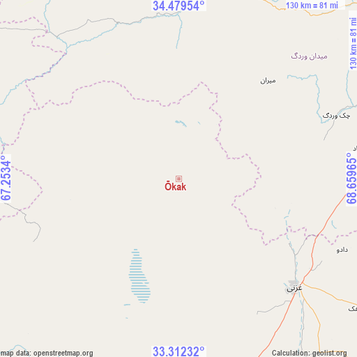
Ōkak GPS coordinates[2]
33° 53' 52.548" North, 67° 57' 23.472" East
| Map corner | latitude | longitude |
|---|---|---|
| Upper-left | 34.47954°, | 67.2534° |
| Center: | 33.89793°, | 67.95652° |
| Lower-right: | 33.31232°, | 68.65965° |
| Map W x H: | 129.8×129.8 km | = 80.7×80.7mi |
| max Lat: | 38.4435° ⇑68.2% North |
| Ōkak: | 33.89793° |
| min Lat: | ⇓31.8% South 30.15° |
| min Long | Ōkak | max Long |
| 61.06667° | 67.95652° | 72.318° |
| W 44.7%⇐ | ⇒55.3% E |
Elevation
Elevation of Ōkak is 3068 m = 10066 ft, and this is 1649.6 m = 5412 ft above average elevation for this country.
| Max E: |
3068 m = 10066 ft | 0% |
| Ōkak | 3068 m 10066 ft | |
| Avg. | 1418.4 m = 4654 ft | |
Min E: |
254 m = 833 ft | 100% |
See also: Afghanistan elevation on elevation.city.
Geographical zone
Ōkak is located in North temperate zone (between Tropic of Cancer and the Arctic Circle). Distance of this Northern Tropic circle is 1163.2 km =722.8 mi to South.| Distance of | km | miles | from Ōkak |
|---|---|---|---|
| North Pole | 6238 | 3876.1 | to North |
| Arctic Circle | 3632.1 | 2256.9 | to North |
| Tropic Cancer | 1163.2 | 722.8 | to South |
| Equator | 3769.1 | 2342 | to South |


Nearby cities:
15 places around Ōkak: (largest is in red/bold)
• Baraki Barak
91.9 km =57.1 mi,  85°
85°
• Chahār Qal‘ah
49.7 km =30.9 mi,  140°
140°
• Charkh
91.3 km =56.7 mi,  97°
97°
• Ghazni
57.5 km =35.7 mi,  131°
131°
• Jalrēz
90.4 km =56.2 mi,  45°
45°
• Kalān Deh
41.7 km =25.9 mi, 99°
• Markaz-e Sayyidābād
70.7 km =43.9 mi,  80°
80°
• Mīray
77.9 km =48.4 mi, 144°
• Mīrān
48.6 km =30.2 mi,  42°
42°
• Pul-e ‘Alam
98.9 km =61.5 mi, 83°
• Qarah Bāgh
79.1 km =49.2 mi,  169°
169°
• Rāmak
74.7 km =46.4 mi,  123°
123°
• Sang-e Māshah
96.9 km =60.2 mi,  209°
209°
• Tōrmay
47.3 km =29.4 mi, 119°
• Wulêswālī Bihsūd
49.8 km =30.9 mi,  354°
354°
Sources, notices
• [Note1] Compared only with cities in Afghanistan existing in our database
• [Src1] Map data: © OpenStreetMap contributors (CC-BY-SA)
• [Src2] Other city data from geonames.org with taken over terms of usage.
• [Src3] Geographical zone / Annual Mean Temperature by Robert A. Rohde @ Wikipedia
