Wulêswālī Bihsūd geodata
Wulêswālī Bihsūd (Vardak) is a seat of a second-order administrative division; located in Afghanistan in Asia/Kabul (GMT+4.5) time zone. In our database, there are 93 cities with bigger population. Compared to other cities in Afghanistan, 59.5% of cities are located further ↑North; 55.6% of cities are located further →East and 99.4% of cities have lower elevation than Wulêswālī Bihsūd. Note1


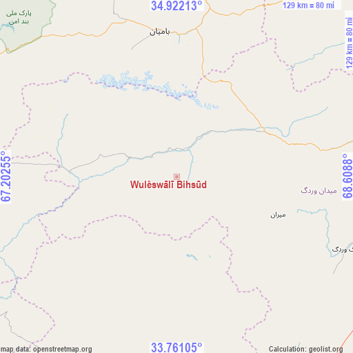
Wulêswālī Bihsūd GPS coordinates[2]
34° 20' 36.96" North, 67° 54' 20.412" East
| Map corner | latitude | longitude |
|---|---|---|
| Upper-left | 34.92213°, | 67.20255° |
| Center: | 34.3436°, | 67.90567° |
| Lower-right: | 33.76105°, | 68.6088° |
| Map W x H: | 129.1×129.1 km | = 80.2×80.2mi |
| max Lat: | 38.4435° ⇑59.5% North |
| Wulêswālī Bihsūd: | 34.3436° |
| min Lat: | ⇓40.5% South 30.15° |
| min Long | Wulêswālī Bi | max Long |
| 61.06667° | 67.90567° | 72.318° |
| W 44.4%⇐ | ⇒55.6% E |
Elevation
Elevation of Wulêswālī Bihsūd is 2960 m = 9711 ft, and this is 1541.6 m = 5058 ft above average elevation for this country.
| Max E: |
3068 m = 10066 ft | 0.59999999999999% |
| Wulêswālī Bihsūd | 2960 m 9711 ft | |
| Avg. | 1418.4 m = 4654 ft | |
Min E: |
254 m = 833 ft | 99.4% |
See also: Afghanistan elevation on elevation.city.
Geographical zone
Wulêswālī Bihsūd is located in North temperate zone (between Tropic of Cancer and the Arctic Circle). Distance of this Northern Tropic circle is 1212.7 km =753.5 mi to South.| Distance of | km | miles | from Wulêswālī Bihsūd |
|---|---|---|---|
| North Pole | 6188.4 | 3845.3 | to North |
| Arctic Circle | 3582.5 | 2226.1 | to North |
| Tropic Cancer | 1212.7 | 753.5 | to South |
| Equator | 3818.7 | 2372.8 | to South |


Nearby cities:
15 places around Wulêswālī Bihsūd: (largest is in red/bold)
• Bulōlah
61.6 km =38.3 mi,  15°
15°
• Bāmyān
53.6 km =33.3 mi,  352°
352°
• Chahār Qal‘ah
95.1 km =59.1 mi,  157°
157°
• Dahan-e Jarf
82.7 km =51.4 mi,  38°
38°
• Jalrēz
70.1 km =43.6 mi,  78°
78°
• Kalān Deh
72.6 km =45.1 mi,  140°
140°
• Khudāydād Khēl
94.9 km =59 mi, 347°
• Markaz-e Sayyidābād
83.5 km =51.9 mi,  117°
117°
• Maydanshakhr
88.3 km =54.9 mi,  86°
86°
• Mīrān
39.8 km =24.7 mi,  110°
110°
• Nayak
97.5 km =60.6 mi,  296°
296°
• Paghmān
99.6 km =61.9 mi,  74°
74°
• Panjāb
81.1 km =50.4 mi,  273°
273°
• Tōrmay
86 km =53.4 mi,  147°
147°
• Ōkak
49.8 km =30.9 mi,  174°
174°
Sources, notices
• [Note1] Compared only with cities in Afghanistan existing in our database
• [Src1] Map data: © OpenStreetMap contributors (CC-BY-SA)
• [Src2] Other city data from geonames.org with taken over terms of usage.
• [Src3] Geographical zone / Annual Mean Temperature by Robert A. Rohde @ Wikipedia
