Zamtō Kêlay geodata
Zamtō Kêlay (Kandahar) is a seat of a second-order administrative division; located in Afghanistan in Asia/Kabul (GMT+4.5) time zone. In our database, there are 93 cities with bigger population. Compared to other cities in Afghanistan, 90% of cities are located further ↑North; 69.8% of cities are located further →East and 70.4% of cities have lower elevation than Zamtō Kêlay. Note1


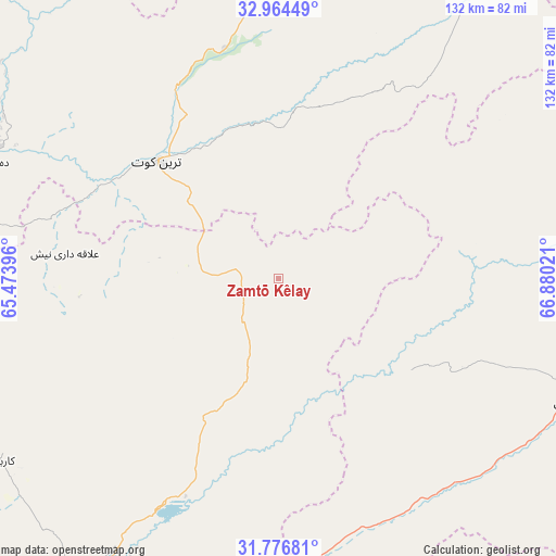
Zamtō Kêlay GPS coordinates[2]
32° 22' 21.36" North, 66° 10' 37.488" East
| Map corner | latitude | longitude |
|---|---|---|
| Upper-left | 32.96449°, | 65.47396° |
| Center: | 32.3726°, | 66.17708° |
| Lower-right: | 31.77681°, | 66.88021° |
| Map W x H: | 132.1×132.1 km | = 82.1×82.1mi |
| max Lat: | 38.4435° ⇑90% North |
| Zamtō Kêlay: | 32.3726° |
| min Lat: | ⇓10% South 30.15° |
| min Long | Zamtō Kêlay | max Long |
| 61.06667° | 66.17708° | 72.318° |
| W 30.2%⇐ | ⇒69.8% E |
Elevation
Elevation of Zamtō Kêlay is 1925 m = 6316 ft, and this is 506.6 m = 1662 ft above average elevation for this country.
| Max E: |
3068 m = 10066 ft | 29.6% |
| Zamtō Kêlay | 1925 m 6316 ft | |
| Avg. | 1418.4 m = 4654 ft | |
Min E: |
254 m = 833 ft | 70.4% |
See also: Afghanistan elevation on elevation.city.
Geographical zone
Zamtō Kêlay is located in North temperate zone (between Tropic of Cancer and the Arctic Circle). Distance of this Northern Tropic circle is 993.6 km =617.4 mi to South.| Distance of | km | miles | from Zamtō Kêlay |
|---|---|---|---|
| North Pole | 6407.6 | 3981.5 | to North |
| Arctic Circle | 3801.7 | 2362.3 | to North |
| Tropic Cancer | 993.6 | 617.4 | to South |
| Equator | 3599.5 | 2236.6 | to South |


Nearby cities:
15 places around Zamtō Kêlay: (largest is in red/bold)
• Arghestān
95.1 km =59.1 mi,  161°
161°
• Babasakhib
92.8 km =57.7 mi,  211°
211°
• Chinār
108.2 km =67.2 mi,  248°
248°
• Dê Nārkhēl Kêlay
51.3 km =31.9 mi,  277°
277°
• Kandahār
95.2 km =59.2 mi, 207°
• Khākirān
98.7 km =61.3 mi,  58°
58°
• Khūgyāṉī
97.8 km =60.8 mi, 157°
• Mīzān ‘Alāqahdārī
38.4 km =23.9 mi,  124°
124°
• Nāyak
60.2 km =37.4 mi,  68°
68°
• Qalāt
74.9 km =46.5 mi,  113°
113°
• Shahr-e Şafā
64.8 km =40.3 mi,  167°
167°
• Sāyagaz
83.1 km =51.6 mi,  75°
75°
• Tarinkot
40.1 km =24.9 mi,  315°
315°
• Uruzgān
75 km =46.6 mi,  34°
34°
• Zīārat-e Shāh Maqşūd
79 km =49.1 mi,  236°
236°
Sources, notices
• [Note1] Compared only with cities in Afghanistan existing in our database
• [Src1] Map data: © OpenStreetMap contributors (CC-BY-SA)
• [Src2] Other city data from geonames.org with taken over terms of usage.
• [Src3] Geographical zone / Annual Mean Temperature by Robert A. Rohde @ Wikipedia
