Chowṉêy geodata
Chowṉêy (Daykundi) is a seat of a second-order administrative division; located in Afghanistan in Asia/Kabul (GMT+4.5) time zone. In our database, there are 93 cities with bigger population. Compared to other cities in Afghanistan, 76.2% of cities are located further ↑North; 68.8% of cities are located further →East and 50.5% of cities have higher elevation than Chowṉêy. Note1


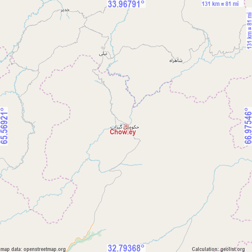
Chowṉêy GPS coordinates[2]
33° 22' 58.008" North, 66° 16' 20.388" East
| Map corner | latitude | longitude |
|---|---|---|
| Upper-left | 33.96791°, | 65.56921° |
| Center: | 33.38278°, | 66.27233° |
| Lower-right: | 32.79368°, | 66.97546° |
| Map W x H: | 130.6×130.6 km | = 81.2×81.2mi |
| max Lat: | 38.4435° ⇑76.2% North |
| Chowṉêy: | 33.38278° |
| min Lat: | ⇓23.8% South 30.15° |
| min Long | Chowṉêy | max Long |
| 61.06667° | 66.27233° | 72.318° |
| W 31.2%⇐ | ⇒68.8% E |
Elevation
Elevation of Chowṉêy is 1347 m = 4419 ft, and this is 71.4 m = 234 ft below average elevation for this country.
| Max E: |
3068 m = 10066 ft | 50.5% |
| Avg. | 1418.4 m = 4654 ft | |
| Chowṉêy | 1347 m = 4419 ft | |
Min E: |
254 m = 833 ft | 49.5% |
See also: Afghanistan elevation on elevation.city.
Geographical zone
Chowṉêy is located in North temperate zone (between Tropic of Cancer and the Arctic Circle). Distance of this Northern Tropic circle is 1105.9 km =687.2 mi to South.| Distance of | km | miles | from Chowṉêy |
|---|---|---|---|
| North Pole | 6295.2 | 3911.7 | to North |
| Arctic Circle | 3689.4 | 2292.5 | to North |
| Tropic Cancer | 1105.9 | 687.2 | to South |
| Equator | 3711.8 | 2306.4 | to South |


Nearby cities:
15 places around Chowṉêy: (largest is in red/bold)
• Dê Nārkhēl Kêlay
121.3 km =75.4 mi,  209°
209°
• Kajrān
76.9 km =47.8 mi,  254°
254°
• Khadīr
67.7 km =42.1 mi,  332°
332°
• Khākirān
96.1 km =59.7 mi,  129°
129°
• La‘l
124.4 km =77.3 mi,  0°
0°
• Nāyak
101.5 km =63.1 mi,  152°
152°
• Nīlī
39.9 km =24.8 mi,  340°
340°
• Panjāb
131.5 km =81.7 mi,  31°
31°
• Quchanghī
75.5 km =46.9 mi, 0°
• Sang-e Māshah
111.9 km =69.5 mi,  103°
103°
• Sar-e Tayghān
57.1 km =35.5 mi,  284°
284°
• Sāyagaz
115.3 km =71.6 mi,  142°
142°
• Tarinkot
91.4 km =56.8 mi,  203°
203°
• Uruzgān
60.7 km =37.7 mi, 146°
• Zamtō Kêlay
112.7 km =70 mi,  184°
184°
Sources, notices
• [Note1] Compared only with cities in Afghanistan existing in our database
• [Src1] Map data: © OpenStreetMap contributors (CC-BY-SA)
• [Src2] Other city data from geonames.org with taken over terms of usage.
• [Src3] Geographical zone / Annual Mean Temperature by Robert A. Rohde @ Wikipedia
