Khudāydād Khēl geodata
Khudāydād Khēl (Bamyan) is a seat of a second-order administrative division; located in Afghanistan in Asia/Kabul (GMT+4.5) time zone. In our database, there are 93 cities with bigger population. Compared to other cities in Afghanistan, 64% of cities are located further ↓South; 57.2% of cities are located further →East and 75.2% of cities have lower elevation than Khudāydād Khēl. Note1


Khudāydād Khēl GPS coordinates[2]
35° 10' 42.06" North, 67° 41' 15.288" East
| Map corner | latitude | longitude |
|---|---|---|
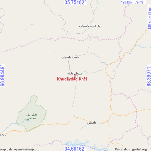
| Upper-left | 35.75102°, | 66.98446° |
| Center: | 35.17835°, | 67.68758° |
| Lower-right: | 34.60162°, | 68.39071° |
| Map W x H: | 127.8×127.8 km | = 79.4×79.4mi |
| max Lat: | 38.4435° ⇑36% North |
| Khudāydād Khēl: | 35.17835° |
| min Lat: | ⇓64% South 30.15° |
| min Long | Khudāydād Kh� | max Long |
| 61.06667° | 67.68758° | 72.318° |
| W 42.8%⇐ | ⇒57.2% E |
Elevation
Elevation of Khudāydād Khēl is 2030 m = 6660 ft, and this is 611.6 m = 2007 ft above average elevation for this country.
| Max E: |
3068 m = 10066 ft | 24.8% |
| Khudāydād Khēl | 2030 m 6660 ft | |
| Avg. | 1418.4 m = 4654 ft | |
Min E: |
254 m = 833 ft | 75.2% |
See also: Afghanistan elevation on elevation.city.
Geographical zone
Khudāydād Khēl is located in North temperate zone (between Tropic of Cancer and the Arctic Circle). Distance of this Northern Tropic circle is 1305.5 km =811.2 mi to South.| Distance of | km | miles | from Khudāydād Khēl |
|---|---|---|---|
| North Pole | 6095.6 | 3787.6 | to North |
| Arctic Circle | 3489.7 | 2168.4 | to North |
| Tropic Cancer | 1305.5 | 811.2 | to South |
| Equator | 3911.5 | 2430.5 | to South |


Nearby cities:
15 places around Khudāydād Khēl: (largest is in red/bold)
• Bulōlah
49.5 km =30.8 mi,  132°
132°
• Bāmyān
41.7 km =25.9 mi,  162°
162°
• Bāzār-e Tālah
54.1 km =33.6 mi,  63°
63°
• Dahan-e Jarf
75.8 km =47.1 mi,  111°
111°
• Dehī
94.2 km =58.5 mi,  336°
336°
• Dōshī
102.3 km =63.6 mi, 62°
• Dūāb
44.4 km =27.6 mi,  15°
15°
• Langar
96.5 km =60 mi, 19°
• Larkird
99.1 km =61.6 mi,  290°
290°
• Nayak
83.2 km =51.7 mi,  233°
233°
• Panjāb
106.8 km =66.4 mi,  214°
214°
• Rū-ye Sang
16.5 km =10.3 mi, 342°
• Siyāhgird
108 km =67.1 mi,  100°
100°
• Wulêswālī Bihsūd
94.9 km =59 mi,  167°
167°
• Ḩukūmatī Dahanah-ye Ghōrī
108.6 km =67.5 mi,  41°
41°
Sources, notices
• [Note1] Compared only with cities in Afghanistan existing in our database
• [Src1] Map data: © OpenStreetMap contributors (CC-BY-SA)
• [Src2] Other city data from geonames.org with taken over terms of usage.
• [Src3] Geographical zone / Annual Mean Temperature by Robert A. Rohde @ Wikipedia
