Villa Unión geodata
Villa Unión (La Rioja) is a seat of a second-order administrative division; located in Argentina in America/Argentina/La_Rioja (GMT-3) time zone. In our database, there are 785 cities with bigger population. Compared to other cities in Argentina, 67.2% of cities are located further ↓South; 90.5% of cities are located further →East and 94% of cities have lower elevation than Villa Unión. Note1


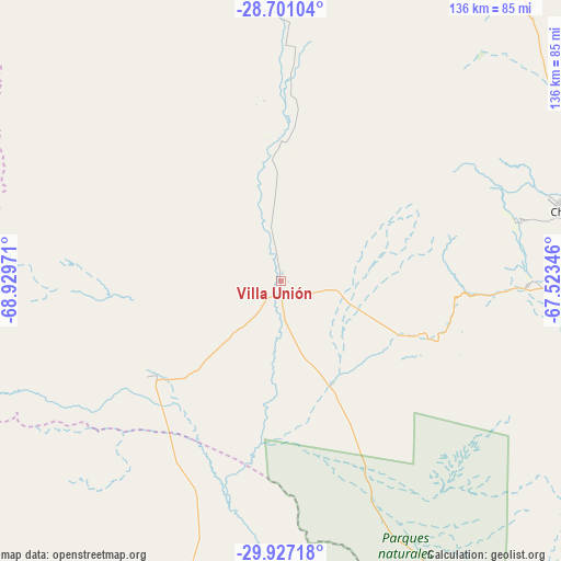
Villa Unión GPS coordinates[2]
29° 18' 57.42" South, 68° 13' 35.688" West
| Map corner | latitude | longitude |
|---|---|---|
| Upper-left | -28.70104°, | -68.92971° |
| Center: | -29.31595°, | -68.22658° |
| Lower-right: | -29.92718°, | -67.52346° |
| Map W x H: | 136.3×136.3 km | = 84.7×84.7mi |
| max Lat: | -21.94467° ⇑32.8% North |
| Villa Unión: | -29.31595° |
| min Lat: | ⇓67.2% South -54.81084° |
| min Long | Villa Unión | max Long |
| -72.88605° | -68.22658° | -53.64581° |
| W 9.5%⇐ | ⇒90.5% E |
Elevation
Elevation of Villa Unión is 1154 m = 3786 ft, and this is 804.7 m = 2640 ft above average elevation for this country.
| Max E: |
4040 m = 13255 ft | 6% |
| Villa Unión | 1154 m 3786 ft | |
| Avg. | 349.3 m = 1146 ft | |
Min E: |
-2 m = -7 ft | 94% |
See also: Argentina elevation on elevation.city.
Geographical zone
Villa Unión is located in South temperate zone (between Tropic of Capricorn and the Antarctic Circle). Distance of this Southern Tropic circle is 653.7 km =406.2 mi to North.| Distance of | km | miles | from Villa Unión |
|---|---|---|---|
| Equator | 3259.6 | 2025.4 | to North |
| Tropic Capricorn | 653.7 | 406.2 | to North |
| Antarctic Circle | 4141.5 | 2573.4 | to South |
| South Pole | 6747.4 | 4192.6 | to South |


Nearby cities:
15 places around Villa Unión: (largest is in red/bold)
• Aimogasta
161.7 km =100.5 mi,  58°
58°
• Aminga
136.3 km =84.7 mi,  67°
67°
• Arauco
161.7 km =100.5 mi, 59°
• Chilecito
72.8 km =45.2 mi,  76°
76°
• Famatina
81.4 km =50.6 mi, 57°
• La Rioja
133.7 km =83.1 mi,  94°
94°
• Patquía
153.2 km =95.2 mi,  122°
122°
• Rodeo
132.8 km =82.5 mi,  221°
221°
• San Blas de los Sauces
149.4 km =92.8 mi,  47°
47°
• San José de Jáchal
114.4 km =71.1 mi,  206°
206°
• Sañogasta
110.6 km =68.7 mi, 77°
• Tinogasta
153.5 km =95.4 mi,  24°
24°
• Villa Bustos
117 km =72.7 mi, 88°
• Villa Castelli
33.5 km =20.8 mi,  0°
0°
• Vinchina
61.9 km =38.5 mi, 1°
Sources, notices
• [Note1] Compared only with cities in Argentina existing in our database
• [Src1] Map data: © OpenStreetMap contributors (CC-BY-SA)
• [Src2] Other city data from geonames.org with taken over terms of usage.
• [Src3] Geographical zone / Annual Mean Temperature by Robert A. Rohde @ Wikipedia
