Wyalong geodata
Wyalong (New South Wales) is a populated place; located in Australia in Australia/Sydney (GMT+11) time zone. With population of 648 people, there are 4448 cities with bigger population in this country. Compared to other cities in Australia, 57% of cities are located further ↑North; 51.8% of cities are located further →East and 85.1% of cities have lower elevation than Wyalong. Note1


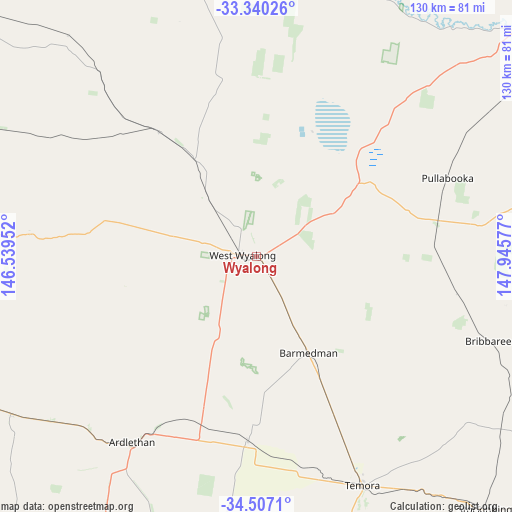
Wyalong GPS coordinates[2]
33° 55' 32.448" South, 147° 14' 33.504" East
| Map corner | latitude | longitude |
|---|---|---|
| Upper-left | -33.34026°, | 146.53952° |
| Center: | -33.92568°, | 147.24264° |
| Lower-right: | -34.5071°, | 147.94577° |
| Map W x H: | 129.7×129.7 km | = 80.6×80.6mi |
| max Lat: | -10.58257° ⇑57% North |
| Wyalong: | -33.92568° |
| min Lat: | ⇓43% South -43.31423° |
| min Long | Wyalong | max Long |
| 113.53327° | 147.24264° | 153.61246° |
| W 48.2%⇐ | ⇒51.8% E |
Elevation
Elevation of Wyalong is 249 m = 817 ft, and this is 127 m = 417 ft above average elevation for this country.
| Max E: |
1715 m = 5627 ft | 14.9% |
| Wyalong | 249 m 817 ft | |
| Avg. | 122 m = 400 ft | |
Min E: |
-2 m = -7 ft | 85.1% |
See also: Australia elevation on elevation.city.
Geographical zone
Wyalong is located in South temperate zone (between Tropic of Capricorn and the Antarctic Circle). Distance of this Southern Tropic circle is 1166.3 km =724.7 mi to North.| Distance of | km | miles | from Wyalong |
|---|---|---|---|
| Equator | 3772.2 | 2343.9 | to North |
| Tropic Capricorn | 1166.3 | 724.7 | to North |
| Antarctic Circle | 3629 | 2255 | to South |
| South Pole | 6234.9 | 3874.2 | to South |


Nearby cities:
15 places around Wyalong: (largest is in red/bold)
• Ardlethan
57.3 km =35.6 mi,  213°
213°
• Barellan
73.5 km =45.7 mi,  237°
237°
• Condobolin
93.4 km =58 mi,  354°
354°
• Coolamon
99.1 km =61.6 mi,  182°
182°
• Forbes
92.9 km =57.7 mi,  49°
49°
• Ganmain
98.3 km =61.1 mi,  190°
190°
• Grenfell
85.1 km =52.9 mi,  87°
87°
• Lake Cargelligo
106.5 km =66.2 mi,  310°
310°
• Leeton
103.8 km =64.5 mi,  227°
227°
• Temora
64.1 km =39.8 mi,  155°
155°
• Ungarie
40.1 km =24.9 mi,  321°
321°
• West Wyalong
3.5 km =2.2 mi,  273°
273°
• Yanco
107 km =66.5 mi, 225°
• Yenda
102.1 km =63.4 mi,  249°
249°
• Young
106.5 km =66.2 mi,  113°
113°
Sources, notices
• [Note1] Compared only with cities in Australia existing in our database
• [Src1] Map data: © OpenStreetMap contributors (CC-BY-SA)
• [Src2] Other city data from geonames.org with taken over terms of usage.
• [Src3] Geographical zone / Annual Mean Temperature by Robert A. Rohde @ Wikipedia
