West Wyalong geodata
West Wyalong (New South Wales) is a populated place; located in Australia in Australia/Sydney (GMT+11) time zone. With population of 3,276 people, there are 2082 cities with bigger population in this country. Compared to other cities in Australia, 56.9% of cities are located further ↑North; 51.9% of cities are located further →East and 85.8% of cities have lower elevation than West Wyalong. Note1


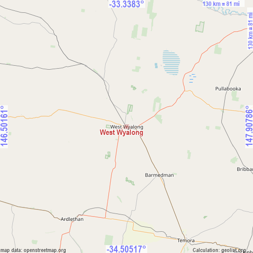
West Wyalong GPS coordinates[2]
33° 55' 25.428" South, 147° 12' 17.028" East
| Map corner | latitude | longitude |
|---|---|---|
| Upper-left | -33.3383°, | 146.50161° |
| Center: | -33.92373°, | 147.20473° |
| Lower-right: | -34.50517°, | 147.90786° |
| Map W x H: | 129.7×129.7 km | = 80.6×80.6mi |
| max Lat: | -10.58257° ⇑56.9% North |
| West Wyalong: | -33.92373° |
| min Lat: | ⇓43.1% South -43.31423° |
| min Long | West Wyalong | max Long |
| 113.53327° | 147.20473° | 153.61246° |
| W 48.1%⇐ | ⇒51.9% E |
Elevation
Elevation of West Wyalong is 262 m = 860 ft, and this is 140 m = 459 ft above average elevation for this country.
| Max E: |
1715 m = 5627 ft | 14.2% |
| West Wyalong | 262 m 860 ft | |
| Avg. | 122 m = 400 ft | |
Min E: |
-2 m = -7 ft | 85.8% |
See also: Australia elevation on elevation.city.
Geographical zone
West Wyalong is located in South temperate zone (between Tropic of Capricorn and the Antarctic Circle). Distance of this Southern Tropic circle is 1166 km =724.5 mi to North.| Distance of | km | miles | from West Wyalong |
|---|---|---|---|
| Equator | 3772 | 2343.8 | to North |
| Tropic Capricorn | 1166 | 724.5 | to North |
| Antarctic Circle | 3629.2 | 2255.1 | to South |
| South Pole | 6235.1 | 3874.3 | to South |


Nearby cities:
15 places around West Wyalong: (largest is in red/bold)
• Ardlethan
55.6 km =34.5 mi,  210°
210°
• Barellan
70.7 km =43.9 mi,  235°
235°
• Bilbul
105.3 km =65.4 mi,  248°
248°
• Condobolin
93 km =57.8 mi,  356°
356°
• Coolamon
99.3 km =61.7 mi,  180°
180°
• Forbes
95.5 km =59.3 mi,  51°
51°
• Ganmain
97.9 km =60.8 mi,  188°
188°
• Grenfell
88.6 km =55.1 mi,  87°
87°
• Lake Cargelligo
103.7 km =64.4 mi,  312°
312°
• Leeton
101.3 km =62.9 mi,  226°
226°
• Temora
65.8 km =40.9 mi,  152°
152°
• Ungarie
37.9 km =23.5 mi,  325°
325°
• Wyalong
3.5 km =2.2 mi, 93°
• Yanco
104.7 km =65.1 mi,  224°
224°
• Yenda
99 km =61.5 mi, 248°
Sources, notices
• [Note1] Compared only with cities in Australia existing in our database
• [Src1] Map data: © OpenStreetMap contributors (CC-BY-SA)
• [Src2] Other city data from geonames.org with taken over terms of usage.
• [Src3] Geographical zone / Annual Mean Temperature by Robert A. Rohde @ Wikipedia
