Kingston South East geodata
Kingston South East (South Australia) is a populated place; located in Australia in Australia/Adelaide (GMT+10.5) time zone. With population of 1,306 people, there are 3468 cities with bigger population in this country. Compared to other cities in Australia, 81.1% of cities are located further ↑North; 76.1% of cities are located further →East and 98.8% of cities have higher elevation than Kingston South East. Note1


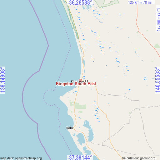
Kingston South East GPS coordinates[2]
36° 49' 50.628" South, 139° 51' 7.92" East
| Map corner | latitude | longitude |
|---|---|---|
| Upper-left | -36.26588°, | 139.14908° |
| Center: | -36.83073°, | 139.8522° |
| Lower-right: | -37.39144°, | 140.55533° |
| Map W x H: | 125.2×125.2 km | = 77.8×77.8mi |
| max Lat: | -10.58257° ⇑81.1% North |
| Kingston South East: | -36.83073° |
| min Lat: | ⇓18.9% South -43.31423° |
| min Long | Kingston South | max Long |
| 113.53327° | 139.8522° | 153.61246° |
| W 23.9%⇐ | ⇒76.1% E |
Elevation
Elevation of Kingston South East is 3 m = 10 ft, and this is 119 m = 390 ft below average elevation for this country.
| Max E: |
1715 m = 5627 ft | 98.8% |
| Avg. | 122 m = 400 ft | |
| Kingston South East | 3 m = 10 ft | |
Min E: |
-2 m = -7 ft | 1.2% |
See also: Australia elevation on elevation.city.
Geographical zone
Kingston South East is located in South temperate zone (between Tropic of Capricorn and the Antarctic Circle). Distance of this Southern Tropic circle is 1489.3 km =925.4 mi to North.| Distance of | km | miles | from Kingston South East |
|---|---|---|---|
| Equator | 4095.2 | 2544.6 | to North |
| Tropic Capricorn | 1489.3 | 925.4 | to North |
| Antarctic Circle | 3306 | 2054.3 | to South |
| South Pole | 5911.9 | 3673.5 | to South |


Nearby cities:
15 places around Kingston South East: (largest is in red/bold)
• Beachport
73.6 km =45.7 mi,  168°
168°
• Bordertown
100.6 km =62.5 mi,  54°
54°
• Compton
131.4 km =81.6 mi,  146°
146°
• Edenhope
130.4 km =81 mi,  100°
100°
• Glencoe
118 km =73.3 mi, 145°
• Kaniva
133.9 km =83.2 mi,  67°
67°
• Keith
92.9 km =57.7 mi,  28°
28°
• Lucindale
48.7 km =30.3 mi,  108°
108°
• Meningie
135.3 km =84.1 mi,  340°
340°
• Millicent
95.6 km =59.4 mi, 152°
• Nangwarry
116.6 km =72.5 mi,  133°
133°
• Naracoorte
80.1 km =49.8 mi, 100°
• Penola
106.2 km =66 mi,  124°
124°
• Robe
37.9 km =23.5 mi,  192°
192°
• Tintinara
106.5 km =66.2 mi,  9°
9°
Sources, notices
• [Note1] Compared only with cities in Australia existing in our database
• [Src1] Map data: © OpenStreetMap contributors (CC-BY-SA)
• [Src2] Other city data from geonames.org with taken over terms of usage.
• [Src3] Geographical zone / Annual Mean Temperature by Robert A. Rohde @ Wikipedia
