Coonabarabran geodata
Coonabarabran (New South Wales) is a populated place; located in Australia in Australia/Sydney (GMT+11) time zone. With population of 3,350 people, there are 2048 cities with bigger population in this country. Compared to other cities in Australia, 70.1% of cities are located further ↓South; 55.8% of cities are located further ←West and 93.7% of cities have lower elevation than Coonabarabran. Note1


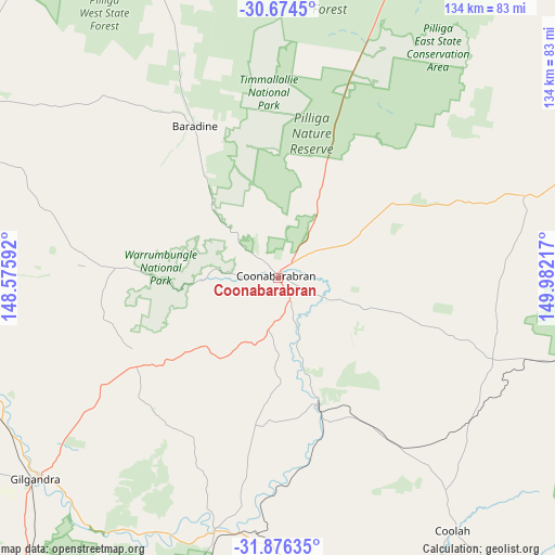
Coonabarabran GPS coordinates[2]
31° 16' 38.424" South, 149° 16' 44.544" East
| Map corner | latitude | longitude |
|---|---|---|
| Upper-left | -30.6745°, | 148.57592° |
| Center: | -31.27734°, | 149.27904° |
| Lower-right: | -31.87635°, | 149.98217° |
| Map W x H: | 133.6×133.6 km | = 83×83mi |
| max Lat: | -10.58257° ⇑29.9% North |
| Coonabarabran: | -31.27734° |
| min Lat: | ⇓70.1% South -43.31423° |
| min Long | Coonabarabran | max Long |
| 113.53327° | 149.27904° | 153.61246° |
| W 55.8%⇐ | ⇒44.2% E |
Elevation
Elevation of Coonabarabran is 518 m = 1699 ft, and this is 396 m = 1299 ft above average elevation for this country.
| Max E: |
1715 m = 5627 ft | 6.3% |
| Coonabarabran | 518 m 1699 ft | |
| Avg. | 122 m = 400 ft | |
Min E: |
-2 m = -7 ft | 93.7% |
See also: Australia elevation on elevation.city.
Geographical zone
Coonabarabran is located in South temperate zone (between Tropic of Capricorn and the Antarctic Circle). Distance of this Southern Tropic circle is 871.8 km =541.7 mi to North.| Distance of | km | miles | from Coonabarabran |
|---|---|---|---|
| Equator | 3477.7 | 2160.9 | to North |
| Tropic Capricorn | 871.8 | 541.7 | to North |
| Antarctic Circle | 3923.5 | 2437.9 | to South |
| South Pole | 6529.3 | 4057.1 | to South |


Nearby cities:
15 places around Coonabarabran: (largest is in red/bold)
• Baradine
41.6 km =25.8 mi,  331°
331°
• Binnaway
32 km =19.9 mi,  162°
162°
• Blair Athol
112.1 km =69.7 mi,  51°
51°
• Boggabri
96.2 km =59.8 mi, 49°
• Coolah
73.9 km =45.9 mi,  145°
145°
• Coonamble
92.1 km =57.2 mi,  292°
292°
• Curlewis
95.7 km =59.5 mi,  79°
79°
• Dunedoo
82.8 km =51.4 mi,  172°
172°
• Gilgandra
75.8 km =47.1 mi,  230°
230°
• Gulargambone
76.9 km =47.8 mi,  265°
265°
• Gulgong
123 km =76.4 mi, 168°
• Gunnedah
98.9 km =61.5 mi,  70°
70°
• Mendooran
62.5 km =38.8 mi,  193°
193°
• Narrabri
116.3 km =72.3 mi,  24°
24°
• Wee Waa
117.8 km =73.2 mi,  7°
7°
Sources, notices
• [Note1] Compared only with cities in Australia existing in our database
• [Src1] Map data: © OpenStreetMap contributors (CC-BY-SA)
• [Src2] Other city data from geonames.org with taken over terms of usage.
• [Src3] Geographical zone / Annual Mean Temperature by Robert A. Rohde @ Wikipedia
