Lansdowne geodata
Lansdowne (Northern Territory) is a section of populated place; located in Australia in Australia/Darwin (GMT+9.5) time zone. With population of 632 people, there are 4485 cities with bigger population in this country. Compared to other cities in Australia, 98.2% of cities are located further ↓South; 87% of cities are located further →East and 75.6% of cities have lower elevation than Lansdowne. Note1


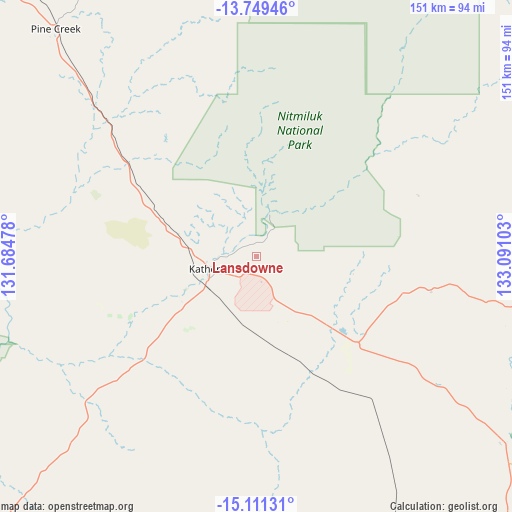
Lansdowne GPS coordinates[2]
14° 25' 53.148" South, 132° 23' 16.44" East
| Map corner | latitude | longitude |
|---|---|---|
| Upper-left | -13.74946°, | 131.68478° |
| Center: | -14.43143°, | 132.3879° |
| Lower-right: | -15.11131°, | 133.09103° |
| Map W x H: | 151.4×151.4 km | = 94.1×94.1mi |
| max Lat: | -10.58257° ⇑1.8% North |
| Lansdowne: | -14.43143° |
| min Lat: | ⇓98.2% South -43.31423° |
| min Long | Lansdowne | max Long |
| 113.53327° | 132.3879° | 153.61246° |
| W 13%⇐ | ⇒87% E |
Elevation
Elevation of Lansdowne is 136 m = 446 ft, and this is 14 m = 46 ft above average elevation for this country.
| Max E: |
1715 m = 5627 ft | 24.4% |
| Lansdowne | 136 m 446 ft | |
| Avg. | 122 m = 400 ft | |
Min E: |
-2 m = -7 ft | 75.6% |
See also: Australia elevation on elevation.city.
Geographical zone
Lansdowne is located in South Torrid zone (between Equator and Tropic of Capricorn). Distance of this Southern Tropic circle is 1001.3 km =622.2 mi to South.| Distance of | km | miles | from Lansdowne |
|---|---|---|---|
| Equator | 1604.6 | 997.1 | to North |
| Tropic Capricorn | 1001.3 | 622.2 | to South |
| Antarctic Circle | 5796.5 | 3601.8 | to South |
| South Pole | 8402.4 | 5221 | to South |


Nearby cities:
15 places around Lansdowne: (largest is in red/bold)
• Acacia Hills
227.5 km =141.4 mi,  323°
323°
• Batchelor
212.3 km =131.9 mi, 316°
• Beswick
79.5 km =49.4 mi,  100°
100°
• Cossack
23.1 km =14.4 mi,  263°
263°
• Darwin River
235.8 km =146.5 mi, 319°
• Douglas-Daly
132 km =82 mi,  302°
302°
• Jabiru
201.7 km =125.3 mi,  13°
13°
• Kakadu
174 km =108.1 mi,  3°
3°
• Katherine
13.9 km =8.6 mi,  254°
254°
• Katherine East
11.7 km =7.3 mi, 250°
• Katherine South
14.5 km =9 mi, 253°
• Marrakai
211.1 km =131.2 mi,  332°
332°
• Mataranka
90.9 km =56.5 mi,  126°
126°
• Miniyeri
202.2 km =125.6 mi,  115°
115°
• Tindal
11.1 km =6.9 mi,  184°
184°
Sources, notices
• [Note1] Compared only with cities in Australia existing in our database
• [Src1] Map data: © OpenStreetMap contributors (CC-BY-SA)
• [Src2] Other city data from geonames.org with taken over terms of usage.
• [Src3] Geographical zone / Annual Mean Temperature by Robert A. Rohde @ Wikipedia
