Şahbuz geodata
Şahbuz (Nakhichevan) is a seat of a second-order administrative division; located in Azerbaijan in Asia/Baku (GMT+4) time zone. With population of 3,127 people, there are 126 cities with bigger population in this country. Compared to other cities in Azerbaijan, 85.4% of cities are located further ↑North; 92.4% of cities are located further →East and 91.4% of cities have lower elevation than Şahbuz. Note1


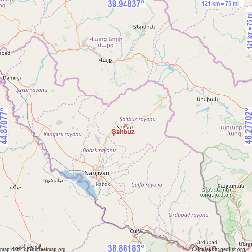
Şahbuz GPS coordinates[2]
39° 24' 25.992" North, 45° 34' 26.004" East
| Map corner | latitude | longitude |
|---|---|---|
| Upper-left | 39.94837°, | 44.87077° |
| Center: | 39.40722°, | 45.57389° |
| Lower-right: | 38.86183°, | 46.27702° |
| Map W x H: | 120.8×120.8 km | = 75.1×75.1mi |
| max Lat: | 41.75259° ⇑85.4% North |
| Şahbuz: | 39.40722° |
| min Lat: | ⇓14.6% South 38.45598° |
| min Long | Şahbuz | max Long |
| 44.84846° | 45.57389° | 50.84003° |
| W 7.6%⇐ | ⇒92.4% E |
Elevation
Elevation of Şahbuz is 1196 m = 3924 ft, and this is 813 m = 2667 ft above average elevation for this country.
| Max E: |
2211 m = 7254 ft | 8.6% |
| Şahbuz | 1196 m 3924 ft | |
| Avg. | 383 m = 1257 ft | |
Min E: |
-26 m = -85 ft | 91.4% |
See also: Azerbaijan elevation on elevation.city.
Geographical zone
Şahbuz is located in North temperate zone (between Tropic of Cancer and the Arctic Circle). Distance of this Northern Tropic circle is 1775.8 km =1103.4 mi to South.| Distance of | km | miles | from Şahbuz |
|---|---|---|---|
| North Pole | 5625.4 | 3495.5 | to North |
| Arctic Circle | 3019.5 | 1876.2 | to North |
| Tropic Cancer | 1775.8 | 1103.4 | to South |
| Equator | 4381.7 | 2722.7 | to South |


Nearby cities:
15 places around Şahbuz: (largest is in red/bold)
• Arafsa
22.3 km =13.9 mi,  124°
124°
• Ashagy Aylis
64 km =39.8 mi,  145°
145°
• Cahri
15.1 km =9.4 mi,  244°
244°
• Culfa
50.6 km =31.4 mi,  174°
174°
• Deste
65 km =40.4 mi, 153°
• Nakhchivan
26.1 km =16.2 mi,  212°
212°
• Ordubad
67.5 km =41.9 mi, 145°
• Oğlanqala
49.5 km =30.8 mi,  293°
293°
• Qıvraq
39.4 km =24.5 mi,  268°
268°
• Sedarak
68.2 km =42.4 mi,  300°
300°
• Sharur City
53.5 km =33.2 mi, 287°
• Sumbatan-diza
55.5 km =34.5 mi,  156°
156°
• Tazakend
30.3 km =18.8 mi,  201°
201°
• Yaycı
53.7 km =33.4 mi, 165°
• Çalxanqala
25.2 km =15.7 mi,  278°
278°
Sources, notices
• [Note1] Compared only with cities in Azerbaijan existing in our database
• [Src1] Map data: © OpenStreetMap contributors (CC-BY-SA)
• [Src2] Other city data from geonames.org with taken over terms of usage.
• [Src3] Geographical zone / Annual Mean Temperature by Robert A. Rohde @ Wikipedia
