Çalxanqala geodata
Çalxanqala (Nakhichevan) is a populated place; located in Azerbaijan in Asia/Baku (GMT+4) time zone. With population of 2,140 people, there are 144 cities with bigger population in this country. Compared to other cities in Azerbaijan, 83.8% of cities are located further ↑North; 97.3% of cities are located further →East and 94.6% of cities have lower elevation than Çalxanqala. Note1


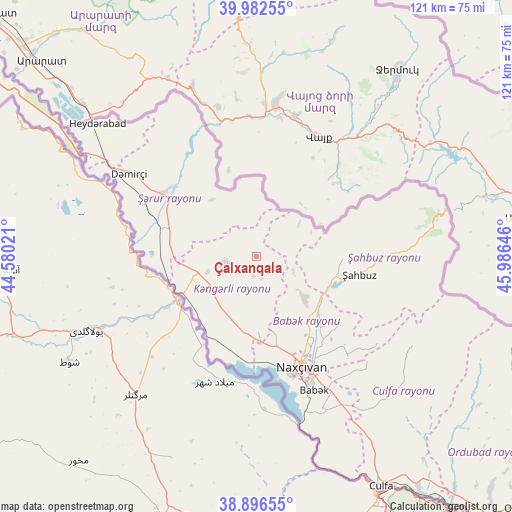
Çalxanqala GPS coordinates[2]
39° 26' 30.012" North, 45° 16' 59.988" East
| Map corner | latitude | longitude |
|---|---|---|
| Upper-left | 39.98255°, | 44.58021° |
| Center: | 39.44167°, | 45.28333° |
| Lower-right: | 38.89655°, | 45.98646° |
| Map W x H: | 120.8×120.8 km | = 75.1×75.1mi |
| max Lat: | 41.75259° ⇑83.8% North |
| Çalxanqala: | 39.44167° |
| min Lat: | ⇓16.2% South 38.45598° |
| min Long | Çalxanqala | max Long |
| 44.84846° | 45.28333° | 50.84003° |
| W 2.7%⇐ | ⇒97.3% E |
Elevation
Elevation of Çalxanqala is 1372 m = 4501 ft, and this is 989 m = 3245 ft above average elevation for this country.
| Max E: |
2211 m = 7254 ft | 5.4% |
| Çalxanqala | 1372 m 4501 ft | |
| Avg. | 383 m = 1257 ft | |
Min E: |
-26 m = -85 ft | 94.6% |
See also: Azerbaijan elevation on elevation.city.
Geographical zone
Çalxanqala is located in North temperate zone (between Tropic of Cancer and the Arctic Circle). Distance of this Northern Tropic circle is 1779.6 km =1105.8 mi to South.| Distance of | km | miles | from Çalxanqala |
|---|---|---|---|
| North Pole | 5621.6 | 3493.1 | to North |
| Arctic Circle | 3015.7 | 1873.9 | to North |
| Tropic Cancer | 1779.6 | 1105.8 | to South |
| Equator | 4385.5 | 2725 | to South |


Nearby cities:
15 places around Çalxanqala: (largest is in red/bold)
• Arafsa
46.4 km =28.8 mi,  110°
110°
• Cahri
15.4 km =9.6 mi,  132°
132°
• Culfa
61.9 km =38.5 mi,  151°
151°
• Deste
82.2 km =51.1 mi,  138°
138°
• Heydarabad
48.6 km =30.2 mi,  309°
309°
• Nakhchivan
28.2 km =17.5 mi,  156°
156°
• Oğlanqala
26 km =16.2 mi, 308°
• Qıvraq
15.2 km =9.4 mi,  251°
251°
• Sedarak
45.7 km =28.4 mi, 311°
• Sharur City
28.8 km =17.9 mi,  295°
295°
• Sumbatan-diza
72.1 km =44.8 mi, 139°
• Tazakend
34.7 km =21.6 mi, 156°
• Yaycı
67.8 km =42.1 mi, 145°
• İstisu
80.7 km =50.1 mi,  45°
45°
• Şahbuz
25.2 km =15.7 mi,  98°
98°
Sources, notices
• [Note1] Compared only with cities in Azerbaijan existing in our database
• [Src1] Map data: © OpenStreetMap contributors (CC-BY-SA)
• [Src2] Other city data from geonames.org with taken over terms of usage.
• [Src3] Geographical zone / Annual Mean Temperature by Robert A. Rohde @ Wikipedia
