Yaycı geodata
Yaycı (Nakhichevan) is a populated place; located in Azerbaijan in Asia/Baku (GMT+4) time zone. With population of 8,500 people, there are 83 cities with bigger population in this country. Compared to other cities in Azerbaijan, 94.6% of cities are located further ↑North; 87% of cities are located further →East and 77.3% of cities have lower elevation than Yaycı. Note1


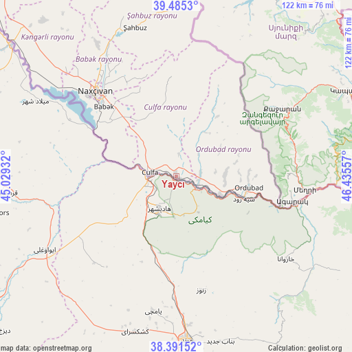
Yaycı GPS coordinates[2]
38° 56' 25.872" North, 45° 43' 56.784" East
| Map corner | latitude | longitude |
|---|---|---|
| Upper-left | 39.4853°, | 45.02932° |
| Center: | 38.94052°, | 45.73244° |
| Lower-right: | 38.39152°, | 46.43557° |
| Map W x H: | 121.6×121.6 km | = 75.6×75.6mi |
| max Lat: | 41.75259° ⇑94.6% North |
| Yaycı: | 38.94052° |
| min Lat: | ⇓5.4% South 38.45598° |
| min Long | Yaycı | max Long |
| 44.84846° | 45.73244° | 50.84003° |
| W 13%⇐ | ⇒87% E |
Elevation
Elevation of Yaycı is 706 m = 2316 ft, and this is 323 m = 1060 ft above average elevation for this country.
| Max E: |
2211 m = 7254 ft | 22.7% |
| Yaycı | 706 m 2316 ft | |
| Avg. | 383 m = 1257 ft | |
Min E: |
-26 m = -85 ft | 77.3% |
See also: Azerbaijan elevation on elevation.city.
Geographical zone
Yaycı is located in North temperate zone (between Tropic of Cancer and the Arctic Circle). Distance of this Northern Tropic circle is 1723.9 km =1071.2 mi to South.| Distance of | km | miles | from Yaycı |
|---|---|---|---|
| North Pole | 5677.3 | 3527.7 | to North |
| Arctic Circle | 3071.4 | 1908.5 | to North |
| Tropic Cancer | 1723.9 | 1071.2 | to South |
| Equator | 4329.8 | 2690.4 | to South |


Nearby cities:
15 places around Yaycı: (largest is in red/bold)
• Arafsa
39.6 km =24.6 mi,  6°
6°
• Ashagy Aylis
22.3 km =13.9 mi,  92°
92°
• Cahri
52.9 km =32.9 mi,  328°
328°
• Culfa
9 km =5.6 mi,  279°
279°
• Deste
16.6 km =10.3 mi,  112°
112°
• Mincivan
86.2 km =53.6 mi,  83°
83°
• Nakhchivan
40.7 km =25.3 mi,  317°
317°
• Ordubad
25.3 km =15.7 mi,  97°
97°
• Qubadlı
85.9 km =53.4 mi,  58°
58°
• Qıvraq
73.7 km =45.8 mi,  313°
313°
• Sumbatan-diza
8.1 km =5 mi, 84°
• Tazakend
34.5 km =21.4 mi, 313°
• Zangilan
81.7 km =50.8 mi, 78°
• Çalxanqala
67.8 km =42.1 mi, 325°
• Şahbuz
53.7 km =33.4 mi,  345°
345°
Sources, notices
• [Note1] Compared only with cities in Azerbaijan existing in our database
• [Src1] Map data: © OpenStreetMap contributors (CC-BY-SA)
• [Src2] Other city data from geonames.org with taken over terms of usage.
• [Src3] Geographical zone / Annual Mean Temperature by Robert A. Rohde @ Wikipedia
