Deste geodata
Deste (Nakhichevan) is a populated place; located in Azerbaijan in Asia/Baku (GMT+4) time zone. With population of 4,282 people, there are 115 cities with bigger population in this country. Compared to other cities in Azerbaijan, 97.3% of cities are located further ↑North; 83.8% of cities are located further →East and 76.8% of cities have lower elevation than Deste. Note1


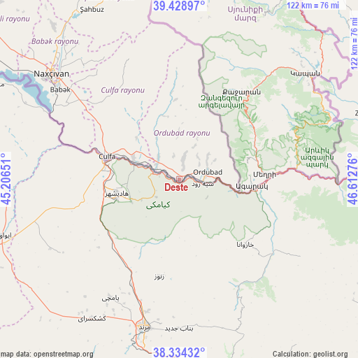
Deste GPS coordinates[2]
38° 53' 1.5" North, 45° 54' 34.668" East
| Map corner | latitude | longitude |
|---|---|---|
| Upper-left | 39.42897°, | 45.20651° |
| Center: | 38.88375°, | 45.90963° |
| Lower-right: | 38.33432°, | 46.61276° |
| Map W x H: | 121.7×121.7 km | = 75.6×75.6mi |
| max Lat: | 41.75259° ⇑97.3% North |
| Deste: | 38.88375° |
| min Lat: | ⇓2.7% South 38.45598° |
| min Long | Deste | max Long |
| 44.84846° | 45.90963° | 50.84003° |
| W 16.2%⇐ | ⇒83.8% E |
Elevation
Elevation of Deste is 696 m = 2283 ft, and this is 313 m = 1027 ft above average elevation for this country.
| Max E: |
2211 m = 7254 ft | 23.2% |
| Deste | 696 m 2283 ft | |
| Avg. | 383 m = 1257 ft | |
Min E: |
-26 m = -85 ft | 76.8% |
See also: Azerbaijan elevation on elevation.city.
Geographical zone
Deste is located in North temperate zone (between Tropic of Cancer and the Arctic Circle). Distance of this Northern Tropic circle is 1717.5 km =1067.2 mi to South.| Distance of | km | miles | from Deste |
|---|---|---|---|
| North Pole | 5683.6 | 3531.6 | to North |
| Arctic Circle | 3077.7 | 1912.4 | to North |
| Tropic Cancer | 1717.5 | 1067.2 | to South |
| Equator | 4323.5 | 2686.5 | to South |


Nearby cities:
15 places around Deste: (largest is in red/bold)
• Arafsa
46.8 km =29.1 mi,  347°
347°
• Ashagy Aylis
8.7 km =5.4 mi,  52°
52°
• Cahri
67 km =41.6 mi,  320°
320°
• Culfa
25.5 km =15.8 mi,  287°
287°
• Mincivan
72.2 km =44.9 mi,  76°
76°
• Nakhchivan
56.1 km =34.9 mi,  310°
310°
• Ordubad
10.2 km =6.3 mi,  73°
73°
• Qubadlı
77.4 km =48.1 mi, 48°
• Qıvraq
89.3 km =55.5 mi, 309°
• Sumbatan-diza
10.2 km =6.3 mi, 314°
• Tazakend
50.3 km =31.3 mi, 306°
• Yaycı
16.6 km =10.3 mi, 292°
• Zangilan
68.5 km =42.6 mi, 71°
• Çalxanqala
82.2 km =51.1 mi, 318°
• Şahbuz
65 km =40.4 mi,  333°
333°
Sources, notices
• [Note1] Compared only with cities in Azerbaijan existing in our database
• [Src1] Map data: © OpenStreetMap contributors (CC-BY-SA)
• [Src2] Other city data from geonames.org with taken over terms of usage.
• [Src3] Geographical zone / Annual Mean Temperature by Robert A. Rohde @ Wikipedia
