Sharur City geodata
Sharur City (Nakhichevan) is a seat of a second-order administrative division; located in Azerbaijan in Asia/Baku (GMT+4) time zone. With population of 7,100 people, there are 92 cities with bigger population in this country. Compared to other cities in Azerbaijan, 81.6% of cities are located further ↑North; 98.9% of cities are located further →East and 82.2% of cities have lower elevation than Sharur City. Note1


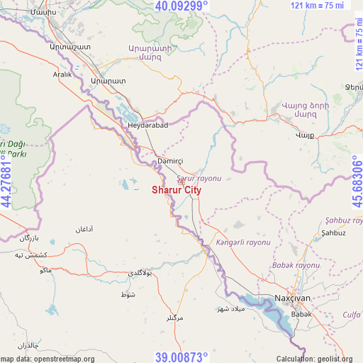
Sharur City GPS coordinates[2]
39° 33' 10.728" North, 44° 58' 47.748" East
| Map corner | latitude | longitude |
|---|---|---|
| Upper-left | 40.09299°, | 44.27681° |
| Center: | 39.55298°, | 44.97993° |
| Lower-right: | 39.00873°, | 45.68306° |
| Map W x H: | 120.6×120.6 km | = 74.9×74.9mi |
| max Lat: | 41.75259° ⇑81.6% North |
| Sharur City: | 39.55298° |
| min Lat: | ⇓18.4% South 38.45598° |
| min Long | Sharur City | max Long |
| 44.84846° | 44.97993° | 50.84003° |
| W 1.1%⇐ | ⇒98.9% E |
Elevation
Elevation of Sharur City is 810 m = 2657 ft, and this is 427 m = 1401 ft above average elevation for this country.
| Max E: |
2211 m = 7254 ft | 17.8% |
| Sharur City | 810 m 2657 ft | |
| Avg. | 383 m = 1257 ft | |
Min E: |
-26 m = -85 ft | 82.2% |
See also: Azerbaijan elevation on elevation.city.
Geographical zone
Sharur City is located in North temperate zone (between Tropic of Cancer and the Arctic Circle). Distance of this Northern Tropic circle is 1792 km =1113.5 mi to South.| Distance of | km | miles | from Sharur City |
|---|---|---|---|
| North Pole | 5609.2 | 3485.4 | to North |
| Arctic Circle | 3003.3 | 1866.2 | to North |
| Tropic Cancer | 1792 | 1113.5 | to South |
| Equator | 4397.9 | 2732.7 | to South |


Nearby cities:
15 places around Sharur City: (largest is in red/bold)
• Arafsa
75.2 km =46.7 mi,  112°
112°
• Cahri
43.8 km =27.2 mi,  121°
121°
• Culfa
87 km =54.1 mi,  139°
139°
• Deste
109.3 km =67.9 mi,  132°
132°
• Heydarabad
22 km =13.7 mi,  329°
329°
• Nakhchivan
53.3 km =33.1 mi, 135°
• Oğlanqala
6.8 km =4.2 mi,  56°
56°
• Qıvraq
20.6 km =12.8 mi,  145°
145°
• Sedarak
19.7 km =12.2 mi,  335°
335°
• Sumbatan-diza
99.1 km =61.6 mi, 132°
• Tazakend
59.5 km =37 mi, 138°
• Yaycı
94 km =58.4 mi, 136°
• Çalxanqala
28.8 km =17.9 mi, 115°
• İstisu
94.6 km =58.8 mi, 62°
• Şahbuz
53.5 km =33.2 mi, 107°
Sources, notices
• [Note1] Compared only with cities in Azerbaijan existing in our database
• [Src1] Map data: © OpenStreetMap contributors (CC-BY-SA)
• [Src2] Other city data from geonames.org with taken over terms of usage.
• [Src3] Geographical zone / Annual Mean Temperature by Robert A. Rohde @ Wikipedia
