Mincivan geodata
Mincivan (Zǝngilan) is a populated place; located in Azerbaijan in Asia/Baku (GMT+4) time zone. With population of 6,353 people, there are 100 cities with bigger population in this country. Compared to other cities in Azerbaijan, 93% of cities are located further ↑North; 69.2% of cities are located further →East and 58.4% of cities have lower elevation than Mincivan. Note1


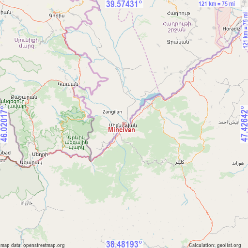
Mincivan GPS coordinates[2]
39° 1' 48.828" North, 46° 43' 23.844" East
| Map corner | latitude | longitude |
|---|---|---|
| Upper-left | 39.57431°, | 46.02017° |
| Center: | 39.03023°, | 46.72329° |
| Lower-right: | 38.48193°, | 47.42642° |
| Map W x H: | 121.5×121.5 km | = 75.5×75.5mi |
| max Lat: | 41.75259° ⇑93% North |
| Mincivan: | 39.03023° |
| min Lat: | ⇓7% South 38.45598° |
| min Long | Mincivan | max Long |
| 44.84846° | 46.72329° | 50.84003° |
| W 30.8%⇐ | ⇒69.2% E |
Elevation
Elevation of Mincivan is 335 m = 1099 ft, and this is 48 m = 157 ft below average elevation for this country.
| Max E: |
2211 m = 7254 ft | 41.6% |
| Avg. | 383 m = 1257 ft | |
| Mincivan | 335 m = 1099 ft | |
Min E: |
-26 m = -85 ft | 58.4% |
See also: Azerbaijan elevation on elevation.city.
Geographical zone
Mincivan is located in North temperate zone (between Tropic of Cancer and the Arctic Circle). Distance of this Northern Tropic circle is 1733.8 km =1077.3 mi to South.| Distance of | km | miles | from Mincivan |
|---|---|---|---|
| North Pole | 5667.3 | 3521.5 | to North |
| Arctic Circle | 3061.4 | 1902.3 | to North |
| Tropic Cancer | 1733.8 | 1077.3 | to South |
| Equator | 4339.8 | 2696.6 | to South |


Nearby cities:
15 places around Mincivan: (largest is in red/bold)
• Arafsa
85.8 km =53.3 mi,  289°
289°
• Ashagy Aylis
64.4 km =40 mi,  260°
260°
• Deste
72.2 km =44.9 mi, 256°
• Fizuli
73.1 km =45.4 mi,  29°
29°
• Hadrut
60.6 km =37.7 mi, 26°
• Horadiz
70.4 km =43.7 mi,  48°
48°
• Jebrail
48.7 km =30.3 mi, 32°
• Laçın
64.9 km =40.3 mi,  346°
346°
• Ordubad
62 km =38.5 mi, 257°
• Qubadlı
37 km =23 mi,  340°
340°
• Qırmızı Bazar
74.5 km =46.3 mi,  15°
15°
• Shushi
81.2 km =50.5 mi,  1°
1°
• Sumbatan-diza
78.1 km =48.5 mi, 263°
• Yaycı
86.2 km =53.6 mi, 263°
• Zangilan
8.1 km =5 mi,  317°
317°
Sources, notices
• [Note1] Compared only with cities in Azerbaijan existing in our database
• [Src1] Map data: © OpenStreetMap contributors (CC-BY-SA)
• [Src2] Other city data from geonames.org with taken over terms of usage.
• [Src3] Geographical zone / Annual Mean Temperature by Robert A. Rohde @ Wikipedia
