Altıağac geodata
Altıağac (Xızı) is a populated place; located in Azerbaijan in Asia/Baku (GMT+4) time zone. With population of 1,126 people, there are 168 cities with bigger population in this country. Compared to other cities in Azerbaijan, 80.5% of cities are located further ↓South; 70.8% of cities are located further ←West and 90.8% of cities have lower elevation than Altıağac. Note1


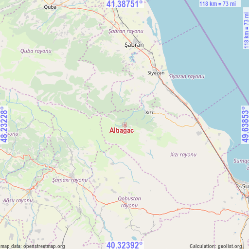
Altıağac GPS coordinates[2]
40° 51' 28.26" North, 48° 56' 7.44" East
| Map corner | latitude | longitude |
|---|---|---|
| Upper-left | 41.38751°, | 48.23228° |
| Center: | 40.85785°, | 48.9354° |
| Lower-right: | 40.32392°, | 49.63853° |
| Map W x H: | 118.3×118.3 km | = 73.5×73.5mi |
| max Lat: | 41.75259° ⇑19.5% North |
| Altıağac: | 40.85785° |
| min Lat: | ⇓80.5% South 38.45598° |
| min Long | Altıağac | max Long |
| 44.84846° | 48.9354° | 50.84003° |
| W 70.8%⇐ | ⇒29.2% E |
Elevation
Elevation of Altıağac is 1155 m = 3789 ft, and this is 772 m = 2533 ft above average elevation for this country.
| Max E: |
2211 m = 7254 ft | 9.2% |
| Altıağac | 1155 m 3789 ft | |
| Avg. | 383 m = 1257 ft | |
Min E: |
-26 m = -85 ft | 90.8% |
See also: Azerbaijan elevation on elevation.city.
Geographical zone
Altıağac is located in North temperate zone (between Tropic of Cancer and the Arctic Circle). Distance of this Northern Tropic circle is 1937 km =1203.6 mi to South.| Distance of | km | miles | from Altıağac |
|---|---|---|---|
| North Pole | 5464.1 | 3395.2 | to North |
| Arctic Circle | 2858.2 | 1776 | to North |
| Tropic Cancer | 1937 | 1203.6 | to South |
| Equator | 4543 | 2822.9 | to South |


Nearby cities:
15 places around Altıağac: (largest is in red/bold)
• Aghsu
55.2 km =34.3 mi,  234°
234°
• Basqal
47.2 km =29.3 mi,  256°
256°
• Divichibazar
38.4 km =23.9 mi,  6°
6°
• Gilgilçay
33.9 km =21.1 mi,  22°
22°
• Hacı Zeynalabdin
58.6 km =36.4 mi,  116°
116°
• Khyzy
13 km =8.1 mi,  64°
64°
• Kilyazi
34.4 km =21.4 mi,  87°
87°
• Kyzyl-Burun
28.8 km =17.9 mi,  31°
31°
• Lahıc
46.5 km =28.9 mi,  268°
268°
• Qobustan
36.1 km =22.4 mi,  180°
180°
• Quba
66.2 km =41.1 mi,  327°
327°
• Shamakhi
35.3 km =21.9 mi,  224°
224°
• Xaçmaz
68.3 km =42.4 mi,  350°
350°
• İsmayıllı
66.5 km =41.3 mi, 262°
• Şuraabad
45 km =28 mi,  95°
95°
Sources, notices
• [Note1] Compared only with cities in Azerbaijan existing in our database
• [Src1] Map data: © OpenStreetMap contributors (CC-BY-SA)
• [Src2] Other city data from geonames.org with taken over terms of usage.
• [Src3] Geographical zone / Annual Mean Temperature by Robert A. Rohde @ Wikipedia
