Thākurgaon geodata
Thākurgaon (Rangpur Division) is a populated place; located in Bangladesh in Asia/Dhaka (GMT+6) time zone. With population of 71,096 people, there are 48 cities with bigger population in this country. Compared to other cities in Bangladesh, 99.1% of cities are located further ↓South; 97.4% of cities are located further →East and 99.1% of cities have lower elevation than Thākurgaon. Note1
Administrative division(s):
- Level 1: Rangpur Division
- Level 2: Thakurgaon
- Level 3: Thakurgaon S.
- Level 4: Paurashava


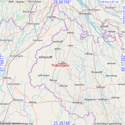
Thākurgaon GPS coordinates[2]
26° 1' 51.492" North, 88° 28' 11.604" East
| Map corner | latitude | longitude |
|---|---|---|
| Upper-left | 26.66106°, | 87.76677° |
| Center: | 26.03097°, | 88.46989° |
| Lower-right: | 25.39748°, | 89.17302° |
| Map W x H: | 140.5×140.5 km | = 87.3×87.3mi |
| max Lat: | 26.33338° ⇑0.9% North |
| Thākurgaon: | 26.03097° |
| min Lat: | ⇓99.1% South 20.85829° |
| min Long | Thākurgaon | max Long |
| 88.15638° | 88.46989° | 92.29773° |
| W 2.6%⇐ | ⇒97.4% E |
Elevation
Elevation of Thākurgaon is 57 m = 187 ft, and this is 39.1 m = 128 ft above average elevation for this country.
| Max E: |
79 m = 259 ft | 0.90000000000001% |
| Thākurgaon | 57 m 187 ft | |
| Avg. | 17.9 m = 59 ft | |
Min E: |
2 m = 7 ft | 99.1% |
See also: Thākurgaon elevation on elevation.city.
Geographical zone
Thākurgaon is located in North temperate zone (between Tropic of Cancer and the Arctic Circle). Distance of this Northern Tropic circle is 288.5 km =179.3 mi to South.| Distance of | km | miles | from Thākurgaon |
|---|---|---|---|
| North Pole | 7112.7 | 4419.6 | to North |
| Arctic Circle | 4506.8 | 2800.4 | to North |
| Tropic Cancer | 288.5 | 179.3 | to South |
| Equator | 2894.4 | 1798.5 | to South |


Nearby cities:
15 places around Thākurgaon: (largest is in red/bold)
• Badarganj
70.6 km =43.9 mi,  124°
124°
• Chilmāri
131.3 km =81.6 mi,  113°
113°
• Dinājpur
47.9 km =29.8 mi,  159°
159°
• Gaibandha
132.9 km =82.6 mi,  125°
125°
• Joypur Hāt
117.5 km =73 mi,  151°
151°
• Lalmonirhat
98.4 km =61.1 mi,  97°
97°
• Nageswari
122.3 km =76 mi,  93°
93°
• Paharpur
122.6 km =76.2 mi, 155°
• Panchagarh
34.7 km =21.6 mi,  14°
14°
• Parbatipur
61.6 km =38.3 mi, 131°
• Pār Naogaon
144.6 km =89.9 mi, 160°
• Pīrgaaj
22.4 km =13.9 mi,  209°
209°
• Rangpur
84.3 km =52.4 mi, 112°
• Saidpur
50.7 km =31.5 mi, 123°
• Shibganj
142.9 km =88.8 mi,  143°
143°
Sources, notices
• [Note1] Compared only with cities in Bangladesh existing in our database
• [Src1] Map data: © OpenStreetMap contributors (CC-BY-SA)
• [Src2] Other city data from geonames.org with taken over terms of usage.
• [Src3] Geographical zone / Annual Mean Temperature by Robert A. Rohde @ Wikipedia
