Gaibandha geodata
Gaibandha (Rangpur Division) is a seat of a second-order administrative division; located in Bangladesh in Asia/Dhaka (GMT+6) time zone. In our database, there are 115 cities with bigger population. Compared to other cities in Bangladesh, 90.6% of cities are located further ↓South; 70.1% of cities are located further →East and 88% of cities have lower elevation than Gaibandha. Note1
Administrative division(s):
- Level 1: Rangpur Division
- Level 2: Gaibandha
- Level 3: Gaibandha S.
- Level 4: Paurashava


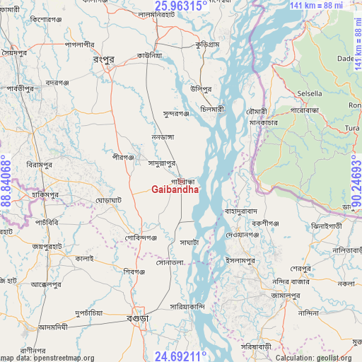
Gaibandha GPS coordinates[2]
25° 19' 45.48" North, 89° 32' 37.68" East
| Map corner | latitude | longitude |
|---|---|---|
| Upper-left | 25.96315°, | 88.84068° |
| Center: | 25.3293°, | 89.5438° |
| Lower-right: | 24.69211°, | 90.24693° |
| Map W x H: | 141.3×141.3 km | = 87.8×87.8mi |
| max Lat: | 26.33338° ⇑9.4% North |
| Gaibandha: | 25.3293° |
| min Lat: | ⇓90.6% South 20.85829° |
| min Long | Gaibandha | max Long |
| 88.15638° | 89.5438° | 92.29773° |
| W 29.9%⇐ | ⇒70.1% E |
Elevation
Elevation of Gaibandha is 28 m = 92 ft, and this is 10.1 m = 33 ft above average elevation for this country.
| Max E: |
79 m = 259 ft | 12% |
| Gaibandha | 28 m 92 ft | |
| Avg. | 17.9 m = 59 ft | |
Min E: |
2 m = 7 ft | 88% |
See also: Bangladesh elevation on elevation.city.
Geographical zone
Gaibandha is located in North temperate zone (between Tropic of Cancer and the Arctic Circle). Distance of this Northern Tropic circle is 210.4 km =130.7 mi to South.| Distance of | km | miles | from Gaibandha |
|---|---|---|---|
| North Pole | 7190.7 | 4468.1 | to North |
| Arctic Circle | 4584.8 | 2848.9 | to North |
| Tropic Cancer | 210.4 | 130.7 | to South |
| Equator | 2816.4 | 1750 | to South |


Nearby cities:
15 places around Gaibandha: (largest is in red/bold)
• Badarganj
62.4 km =38.8 mi,  307°
307°
• Bogra
56 km =34.8 mi,  198°
198°
• Chilmāri
28.3 km =17.6 mi,  26°
26°
• Jamālpur
61.1 km =38 mi,  138°
138°
• Joypur Hāt
57.8 km =35.9 mi,  244°
244°
• Lalmonirhat
66.1 km =41.1 mi,  351°
351°
• Mahasthangarh
45.7 km =28.4 mi,  206°
206°
• Nageswari
72.6 km =45.1 mi,  11°
11°
• Paharpur
66.3 km =41.2 mi, 239°
• Parbatipur
71.9 km =44.7 mi,  301°
301°
• Rangpur
54.9 km =34.1 mi,  327°
327°
• Saidpur
82.2 km =51.1 mi, 307°
• Sarishābāri
70.5 km =43.8 mi,  155°
155°
• Sherpur
58.9 km =36.6 mi,  125°
125°
• Shibganj
42.7 km =26.5 mi, 211°
Sources, notices
• [Note1] Compared only with cities in Bangladesh existing in our database
• [Src1] Map data: © OpenStreetMap contributors (CC-BY-SA)
• [Src2] Other city data from geonames.org with taken over terms of usage.
• [Src3] Geographical zone / Annual Mean Temperature by Robert A. Rohde @ Wikipedia
