Joypur Hāt geodata
Joypur Hāt (Rajshahi Division) is a populated place; located in Bangladesh in Asia/Dhaka (GMT+6) time zone. With population of 73,068 people, there are 47 cities with bigger population in this country. Compared to other cities in Bangladesh, 89.7% of cities are located further ↓South; 86.3% of cities are located further →East and 79.5% of cities have lower elevation than Joypur Hāt. Note1
Administrative division(s):
- Level 1: Rajshahi Division
- Level 2: Joypurhat
- Level 3: Joypurhat Sadar
- Level 4: Paurashava


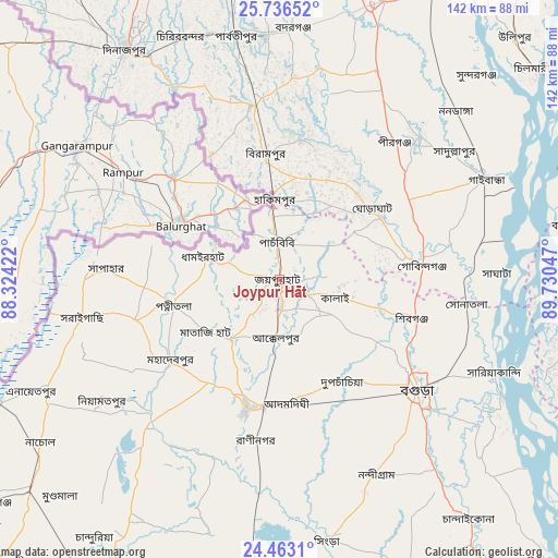
Joypur Hāt GPS coordinates[2]
25° 6' 5.292" North, 89° 1' 38.424" East
| Map corner | latitude | longitude |
|---|---|---|
| Upper-left | 25.73652°, | 88.32422° |
| Center: | 25.10147°, | 89.02734° |
| Lower-right: | 24.4631°, | 89.73047° |
| Map W x H: | 141.6×141.6 km | = 88×88mi |
| max Lat: | 26.33338° ⇑10.3% North |
| Joypur Hāt: | 25.10147° |
| min Lat: | ⇓89.7% South 20.85829° |
| min Long | Joypur Hāt | max Long |
| 88.15638° | 89.02734° | 92.29773° |
| W 13.7%⇐ | ⇒86.3% E |
Elevation
Elevation of Joypur Hāt is 24 m = 79 ft, and this is 6.1 m = 20 ft above average elevation for this country.
| Max E: |
79 m = 259 ft | 20.5% |
| Joypur Hāt | 24 m 79 ft | |
| Avg. | 17.9 m = 59 ft | |
Min E: |
2 m = 7 ft | 79.5% |
See also: Joypur Hāt elevation on elevation.city.
Geographical zone
Joypur Hāt is located in North temperate zone (between Tropic of Cancer and the Arctic Circle). Distance of this Northern Tropic circle is 185.1 km =115 mi to South.| Distance of | km | miles | from Joypur Hāt |
|---|---|---|---|
| North Pole | 7216 | 4483.8 | to North |
| Arctic Circle | 4610.2 | 2864.6 | to North |
| Tropic Cancer | 185.1 | 115 | to South |
| Equator | 2791 | 1734.2 | to South |


Nearby cities:
15 places around Joypur Hāt: (largest is in red/bold)
• Badarganj
63.7 km =39.6 mi,  2°
2°
• Bogra
44.5 km =27.7 mi,  128°
128°
• Chilmāri
82.1 km =51 mi,  51°
51°
• Dinājpur
70.4 km =43.7 mi,  326°
326°
• Gaibandha
57.8 km =35.9 mi,  64°
64°
• Mahasthangarh
35.4 km =22 mi,  116°
116°
• Natore
76.9 km =47.8 mi,  183°
183°
• Paharpur
9.8 km =6.1 mi,  211°
211°
• Parbatipur
63.3 km =39.3 mi,  351°
351°
• Puthia
84.1 km =52.3 mi,  193°
193°
• Pār Naogaon
34 km =21.1 mi, 193°
• Rangpur
75.2 km =46.7 mi,  17°
17°
• Saidpur
76.4 km =47.5 mi, 349°
• Sarishābāri
89.9 km =55.9 mi, 115°
• Shibganj
31.8 km =19.8 mi,  110°
110°
Sources, notices
• [Note1] Compared only with cities in Bangladesh existing in our database
• [Src1] Map data: © OpenStreetMap contributors (CC-BY-SA)
• [Src2] Other city data from geonames.org with taken over terms of usage.
• [Src3] Geographical zone / Annual Mean Temperature by Robert A. Rohde @ Wikipedia
