Chilmāri geodata
Chilmāri (Rangpur Division) is a populated place; located in Bangladesh in Asia/Dhaka (GMT+6) time zone. With population of 49,736 people, there are 63 cities with bigger population in this country. Compared to other cities in Bangladesh, 91.5% of cities are located further ↓South; 65.8% of cities are located further →East and 87.2% of cities have lower elevation than Chilmāri. Note1
Administrative division(s):
- Level 1: Rangpur Division
- Level 2: Kurigram
- Level 3: Chilmari
- Level 4: Ramna


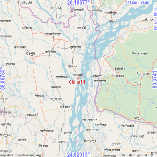
Chilmāri GPS coordinates[2]
25° 33' 22.068" North, 89° 40' 15.492" East
| Map corner | latitude | longitude |
|---|---|---|
| Upper-left | 26.18877°, | 88.96785° |
| Center: | 25.55613°, | 89.67097° |
| Lower-right: | 24.92013°, | 90.3741° |
| Map W x H: | 141.1×141.1 km | = 87.7×87.7mi |
| max Lat: | 26.33338° ⇑8.5% North |
| Chilmāri: | 25.55613° |
| min Lat: | ⇓91.5% South 20.85829° |
| min Long | Chilmāri | max Long |
| 88.15638° | 89.67097° | 92.29773° |
| W 34.2%⇐ | ⇒65.8% E |
Elevation
Elevation of Chilmāri is 27 m = 89 ft, and this is 9.1 m = 30 ft above average elevation for this country.
| Max E: |
79 m = 259 ft | 12.8% |
| Chilmāri | 27 m 89 ft | |
| Avg. | 17.9 m = 59 ft | |
Min E: |
2 m = 7 ft | 87.2% |
See also: Chilmāri elevation on elevation.city.
Geographical zone
Chilmāri is located in North temperate zone (between Tropic of Cancer and the Arctic Circle). Distance of this Northern Tropic circle is 235.7 km =146.5 mi to South.| Distance of | km | miles | from Chilmāri |
|---|---|---|---|
| North Pole | 7165.5 | 4452.4 | to North |
| Arctic Circle | 4559.6 | 2833.2 | to North |
| Tropic Cancer | 235.7 | 146.5 | to South |
| Equator | 2841.6 | 1765.7 | to South |


Nearby cities:
15 places around Chilmāri: (largest is in red/bold)
• Badarganj
63.3 km =39.3 mi,  281°
281°
• Bogra
84 km =52.2 mi,  201°
201°
• Gaibandha
28.3 km =17.6 mi,  206°
206°
• Jamālpur
76.1 km =47.3 mi,  158°
158°
• Joypur Hāt
82.1 km =51 mi,  231°
231°
• Lalmonirhat
46 km =28.6 mi,  330°
330°
• Mahasthangarh
73.9 km =45.9 mi, 206°
• Nageswari
45.9 km =28.5 mi,  2°
2°
• Paharpur
91.4 km =56.8 mi, 229°
• Parbatipur
75.2 km =46.7 mi, 279°
• Rangpur
47.1 km =29.3 mi,  296°
296°
• Saidpur
81.9 km =50.9 mi,  287°
287°
• Sarishābāri
90.9 km =56.5 mi,  169°
169°
• Sherpur
69.2 km =43 mi,  149°
149°
• Shibganj
70.9 km =44.1 mi, 209°
Sources, notices
• [Note1] Compared only with cities in Bangladesh existing in our database
• [Src1] Map data: © OpenStreetMap contributors (CC-BY-SA)
• [Src2] Other city data from geonames.org with taken over terms of usage.
• [Src3] Geographical zone / Annual Mean Temperature by Robert A. Rohde @ Wikipedia
